 Only the areas outlined in red have detail maps (so far).
Only the areas outlined in red have detail maps (so far).
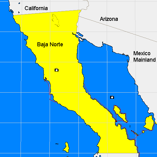
This large scale map of Baja Norte was generated with the
Xerox PARC Map Viewer
then I added a little more detail and color to suit. The high resolution
maps that this leads to were scanned off of the SSP (Secretaria de
programacion y presupuesto) Mexican topographic maps. These paper
maps were purchased from Map Centre Inc.
in San Diego. I scanned the 1:50,000 scale maps when they were available
but had to use the 1:250,000 maps for a few of the pages. After scanning
I adjusted them to the same approximate scale, but you may notice a
change in the resolution of the topographic contour lines. I traced
the shorelines, painted the ocean blue, and re-typset all the place names.
The resulting map images have little left to them from the original besides the
general outline of the shoreline and a texture that gives an
idea of the terrain onshore.