 Clicking on areas of this map should lead you to more
and more detailed maps until you can see kayak trails as red lines
on the ocean. Clicking on these will bring up a kayak journal entry
about each location along the coast.
Clicking on areas of this map should lead you to more
and more detailed maps until you can see kayak trails as red lines
on the ocean. Clicking on these will bring up a kayak journal entry
about each location along the coast.
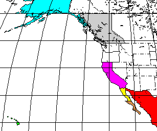
Click on the colored areas to get more detailed maps.
Clicking on areas of this map should lead you to more
and more detailed maps until you can see kayak trails as red lines
on the ocean. Clicking on these will bring up a kayak journal entry
about each location along the coast.
I have been over some areas many times, with journal entries for each
trip. In these places I have put in a pointer to my favorite story
about the location, or the most recent journal entry. Usually the
stories have links back to previous trips in the same location, so you can find
out more about a spot if you are interested.
A few of the maps came from the Xerox PARC Map Viewer. I stole several of the mid level maps from other sites. Many of the older detailed maps (with a scale of 1:50,000) all came from the Tiger Mapping Service put on the WEB by the US Census Bureau. The Census Bureau has combined data from many different places to build these maps. The database of county borders is digitized at a much lower resolution than the shoreline. This results in maps that have sections of land painted ocean colors when the shoreline sticks out past the county "line" and sections of ocean painted county colors. I had to run along the shoreline in each map and correct these defects. Even the detail of the shoreline changes from place to place. For some reason the remote Mendocino Headlands is rendered in incredible detail while the cosmopolitan Angel Island is rendered as a mere dozen straight lines. As I corrected the shoreline problems I added more details from the USGS 7-1/2 degree topographic maps. This allowed me to put in all the major offshore rocks, and a smattering of pixels for fields of smaller rocks. I added labels for all the bays, coves, and points along the shore. And, of course, I added lines in the water indicating approximate paths of me and my kayak.
After all this work, I now consider the resulting bitmap-maps my own, although I am grateful for the Census Bureau for supplying the original data.
The newer detailed maps were cut from the Topo! program by Wildflower Productions.
| All text and images Copyright © 2008 by Mike Higgins / contact |