Sea Ranch Shell Beach to Gualala Point Park, March 29, 1995
Click on the small image to see the full-sized one.
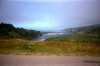 Gualala River mouth viewed from Highway One
Links to related images: Nearby. Proofs. Map.
Approximate location: 38.7366981506348N / 123.498001098633W.
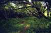 The green picnic spot at Gualala Park
Links to related images: Nearby. Proofs. Map.
Approximate location: 38.7366981506348N / 123.498001098633W.
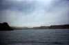 Looking up the Gualala River
Links to related images: Nearby. Proofs. Map.
Approximate location: 38.7366981506348N / 123.498001098633W.
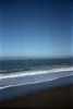
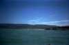
 Gualala Beach viewed from offshore
Links to related images: Nearby. Proofs. Map.
Approximate location: 38.7366981506348N / 123.498001098633W.

 Waves breaking on Gualala Beach, osprey diving
Links to related images: Nearby. Proofs. Map.
Approximate location: 38.7366981506348N / 123.498001098633W.
 The shore of the Gualala River
Links to related images: Nearby. Proofs. Map.
Approximate location: 38.7366981506348N / 123.498001098633W.
 Gualala Beach from a distance offshore
Links to related images: Nearby. Proofs. Map.
Approximate location: 38.7366981506348N / 123.498001098633W.
 The rugged shoreline south of Gualala Beach
Links to related images: Nearby. Proofs. Map.
Approximate location: 38.7366981506348N / 123.498001098633W.
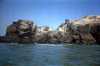 Gualala Point Island up close
Links to related images: Nearby. Proofs. Map.
Approximate location: 38.7366981506348N / 123.498001098633W.
 Big crack in Gualala Point Island
Links to related images: Nearby. Proofs. Map.
Approximate location: 38.7366981506348N / 123.498001098633W.
 East end of Gualala Point Island
Links to related images: Nearby. Proofs. Map.
Approximate location: 38.7366981506348N / 123.498001098633W.
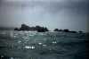
 Rough waves on Gualala Point Island
Links to related images: Nearby. Proofs. Map.
Approximate location: 38.7366981506348N / 123.498001098633W.
 West end of Gualala Point Island
Links to related images: Nearby. Proofs. Map.
Approximate location: 38.7366981506348N / 123.498001098633W.
 Jagged rocks on Gualala Point Island
Links to related images: Nearby. Proofs. Map.
Approximate location: 38.7366981506348N / 123.498001098633W.
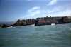
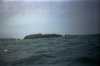 Approaching Gualala Point Island
Links to related images: Nearby. Proofs. Map.
Approximate location: 38.7366981506348N / 123.498001098633W.
 Vertical layers in Gualala Point Island
Links to related images: Nearby. Proofs. Map.
Approximate location: 38.7366981506348N / 123.498001098633W.
 Gualala Point Island up close
Links to related images: Nearby. Proofs. Map.
Approximate location: 38.7366981506348N / 123.498001098633W.
All text and images Copyright © 1995 by Mike Higgins / contact