Point Reyes Beach South to Drakes Bay Boat Launch. July 20th 1995
Click on the small image to see the full-sized one.
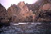
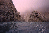
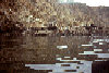
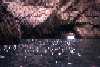 large arch f/inside
Links to related images: Nearby. Proofs. Map.
Approximate location: 37.9953155517578N / 123.011016845703W.
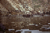
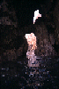 small arch up close
Links to related images: Nearby. Proofs. Map.
Approximate location: 37.9951477050781N / 123.010437011719W.
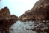
 view E of arch
Links to related images: Nearby. Proofs. Map.
Approximate location: 37.9948768615723N / 123.01091003418W.
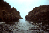
 gap & small arch
Links to related images: Nearby. Proofs. Map.
Approximate location: 37.9949798583984N / 123.009407043457W.
 gap between rocks
Links to related images: Nearby. Proofs. Map.
Approximate location: 37.9939994812012N / 123.006706237793W.
 cracks
Links to related images: Nearby. Proofs. Map.
Approximate location: 37.9929161071777N / 123.003616333008W.
 rock, isolated
Links to related images: Nearby. Proofs. Map.
Approximate location: 37.9934577941895N / 122.998466491699W.
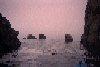
 channel out between
Links to related images: Nearby. Proofs. Map.
Approximate location: 37.9921035766602N / 122.994522094727W.
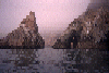
 points & rocks
Links to related images: Nearby. Proofs. Map.
Approximate location: 37.9937286376953N / 122.990394592285W.
 channel behin rocks
Links to related images: Nearby. Proofs. Map.
Approximate location: 37.993049621582N / 122.987480163574W.
 path between rocks
Links to related images: Nearby. Proofs. Map.
Approximate location: 37.992374420166N / 122.984214782715W.
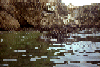
 hidden beach
Links to related images: Nearby. Proofs. Map.
Approximate location: 37.9922409057617N / 122.980445861816W.
 rocks & point
Links to related images: Nearby. Proofs. Map.
Approximate location: 37.9919700622559N / 122.977348327637W.
 small arch
Links to related images: Nearby. Proofs. Map.
Approximate location: 37.9912910461426N / 122.974601745605W.
 overlook down
Links to related images: Nearby. Proofs. Map.
Approximate location: 37.9900741577148N / 122.969451904297W.
 chimney rock
Links to related images: Nearby. Proofs. Map.
Approximate location: 37.9894065856934N / 122.96395111084W.
 close rock
Links to related images: Nearby. Proofs. Map.
Approximate location: 37.9939460754395N / 122.967758178711W.
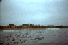
 drakes bay
Links to related images: Nearby. Proofs. Map.
Approximate location: 37.9934387207031N / 122.96688079834W.
 secluded beach
Links to related images: Nearby. Proofs. Map.
Approximate location: 37.990852355957N / 122.965454101562W.
 stainless box
Links to related images: Nearby. Proofs. Map.
Approximate location: 37.9911499023438N / 122.965530395508W.
 red scum on R
Links to related images: Nearby. Proofs. Map.
Approximate location: 37.9905815124512N / 122.964935302734W.
 row of rocks
Links to related images: Nearby. Proofs. Map.
Approximate location: 37.9903945922852N / 122.963844299316W.
 chimney rock
Links to related images: Nearby. Proofs. Map.
Approximate location: 37.9901580810547N / 122.963256835938W.
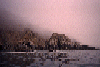
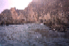
 rocks in fog
Links to related images: Nearby. Proofs. Map.
Approximate location: 37.9897270202637N / 122.971656799316W.
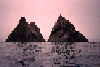 two pyram. rocks
Links to related images: Nearby. Proofs. Map.
Approximate location: 37.9897384643555N / 122.972763061523W.
 safe beach
Links to related images: Nearby. Proofs. Map.
Approximate location: 37.9904479980469N / 122.974113464355W.
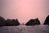
 rocks in fog
Links to related images: Nearby. Proofs. Map.
Approximate location: 37.9917678833008N / 122.976829528809W.
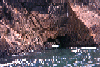 arch outside
Links to related images: Nearby. Proofs. Map.
Approximate location: 37.9919929504395N / 122.977264404297W.
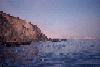
 Calm water inside Drakes Bay
Links to related images: Nearby. Proofs. Map.
Approximate location: 37.9935760498047N / 122.967010498047W.
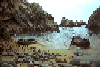
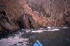
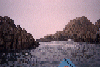
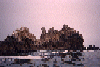
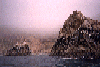
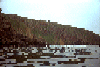
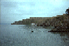
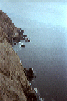
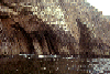 Rock Gardens on west side of Point Reyes
Links to related images: Nearby. Proofs. Map.
Approximate location: 37.9950790405273N / 123.008422851562W.

 Point Reyes Lighthouse
Links to related images: Nearby. Proofs. Map.
Approximate location: 37.9959526062012N / 123.024482727051W.
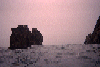
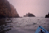
 Rough water around Point Reyes Point
Links to related images: Nearby. Proofs. Map.
Approximate location: 38.00390625N / 123.014053344727W.
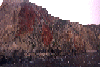
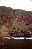 Red lichen on the cliffs of the point
Links to related images: Nearby. Proofs. Map.
Approximate location: 38.0083885192871N / 123.011054992676W.
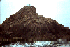
 Closeup of the end of Point Reyes Point
Links to related images: Nearby. Proofs. Map.
Approximate location: 38.0020561218262N / 123.018013000488W.
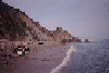
 Dunes offshore from Point Reyes Beach South
Links to related images: Nearby. Proofs. Map.
Approximate location: 38.0484962463379N / 122.990676879883W.
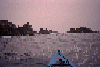
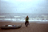
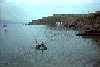 The intrepid kayaker coming in for a landing in Drakes Bay
Links to related images: Nearby. Proofs. Map.
Approximate location: 37.9955787658691N / 122.976913452148W.
 View of the intrepid kayaker from the top of Point Reyes
Links to related images: Nearby. Proofs. Map.
Approximate location: 37.9928321838379N / 122.973266601562W.
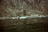
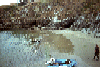
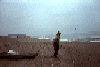
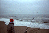 A fisherman in front of the intrepid kayaker at Point Reyes Beach South
Links to related images: Nearby. Proofs. Map.
Approximate location: 38.0484809875488N / 122.989227294922W.
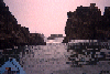
 The intrepid kayaker makes it over the surf at Point Reyes Beach South
Links to related images: Nearby. Proofs. Map.
Approximate location: 38.0487403869629N / 122.9892578125W.
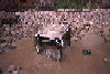
 The intrepid kayaker draging his kayak into the water at Point Reyes Beach South
Links to related images: Nearby. Proofs. Map.
Approximate location: 38.048942565918N / 122.988967895508W.
All text and images Copyright © 1995 by Mike Higgins / contact