Point Molate, October 2nd, 1995
Click on the small image to see the full-sized one.
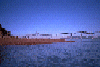
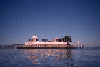
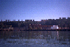
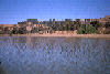 Launching from Point Molate Park
Links to related images: Nearby. Proofs. Map.
Approximate location: 37.9426574707031N / 122.411499023438W.
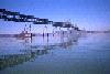
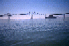
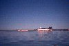
 Going under the Richmond - San Rafael Bridge
Links to related images: Nearby. Proofs. Map.
Approximate location: 37.9328575134277N / 122.419151306152W.
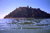
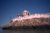
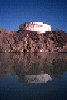
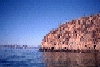
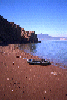 Landed on the red sand beach on Red Rock Island
Links to related images: Nearby. Proofs. Map.
Approximate location: 37.9300155639648N / 122.431037902832W.
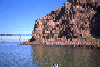


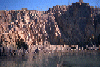
 Circumnavigating Red Rock Island
Links to related images: Nearby. Proofs. Map.
Approximate location: 37.9298706054688N / 122.430152893066W.
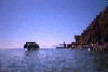
 Leaving Red Rock Island
Links to related images: Nearby. Proofs. Map.
Approximate location: 37.9333686828613N / 122.428291320801W.
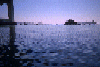
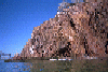
 Red Rock Island and the bridge
Links to related images: Nearby. Proofs. Map.
Approximate location: 37.9447402954102N / 122.429237365723W.
 West and East Brother Islands
Links to related images: Nearby. Proofs. Map.
Approximate location: 37.9622764587402N / 122.435554504395W.
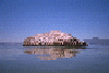
 West Brother Island
Links to related images: Nearby. Proofs. Map.
Approximate location: 37.9624786376953N / 122.435920715332W.
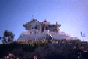
 East Brother Island
Links to related images: Nearby. Proofs. Map.
Approximate location: 37.9632301330566N / 122.434196472168W.
 West Brother Island
Links to related images: Nearby. Proofs. Map.
Approximate location: 37.963207244873N / 122.434143066406W.


 East Brother Island
Links to related images: Nearby. Proofs. Map.
Approximate location: 37.9625129699707N / 122.433181762695W.
 West and East Brother Islands
Links to related images: Nearby. Proofs. Map.
Approximate location: 37.9592208862305N / 122.431510925293W.
 Molasses tank on the Richmond shoreline
Links to related images: Nearby. Proofs. Map.
Approximate location: 37.9609222412109N / 122.427177429199W.
 Pocket Beach on the Richmond shoreline
Links to related images: Nearby. Proofs. Map.
Approximate location: 37.9609832763672N / 122.426704406738W.
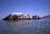
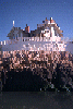
 Brick castle on the Richmond shoreline
Links to related images: Nearby. Proofs. Map.
Approximate location: 37.951847076416N / 122.419486999512W.
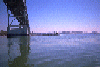
 Richmond - San Rafael Bridge viewed past the Richmond Shoreline
Links to related images: Nearby. Proofs. Map.
Approximate location: 37.9464645385742N / 122.419281005859W.
All text and images Copyright © 1995 by Mike Higgins / contact