Duncans Landing to Arched Rock Beach, October 6th, 1995.
Click on the small image to see the full-sized one.
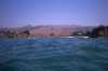
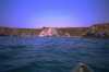 Arched Rock Beach from offshore.
Links to related images: Nearby. Proofs. Map.
Approximate location: 38.3791999816895N / 123.082000732422W.
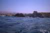
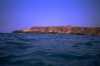 Rugged area north of Arched Rock Beach
Links to related images: Nearby. Proofs. Map.
Approximate location: 38.3791999816895N / 123.082000732422W.
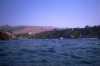
 Houses on the cliff edge near Gleasons Beach
Links to related images: Nearby. Proofs. Map.
Approximate location: 38.3791999816895N / 123.082000732422W.
 Grandma's Beach, the name for this section of Gleasons Beach
Links to related images: Nearby. Proofs. Map.
Approximate location: 38.3791999816895N / 123.082000732422W.
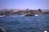
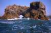
 Rough rocks offshore from Grandma's Beach
Links to related images: Nearby. Proofs. Map.
Approximate location: 38.3791999816895N / 123.082000732422W.
 The arch at Arched Rock Beach
Links to related images: Nearby. Proofs. Map.
Approximate location: 38.3791999816895N / 123.082000732422W.
All text and images Copyright © 1995 by Mike Higgins / contact