Stengel to Shell Beach, January 11th 1996
Click on the small image to see the full-sized one.
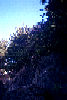
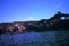 Sea Ranch Stengel Beach in bad light
Links to related images: Nearby. Proofs. Map.
Approximate location: 38.7366981506348N / 123.498001098633W.
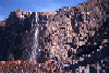

 Waterfall at Sea Ranch at Stengel Beach
Links to related images: Nearby. Proofs. Map.
Approximate location: 38.7366981506348N / 123.498001098633W.
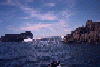 Wave breaking between rocks near Stengel Beach
Links to related images: Nearby. Proofs. Map.
Approximate location: 38.7366981506348N / 123.498001098633W.

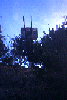
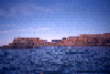
 Here is the mysterious deck, but the light was poor on this
winter morning, and
Here is the mysterious deck, but the light was poor on this
winter morning, and
Links to related images: Nearby. Proofs. Map.
Approximate location: 38.7366981506348N / 123.498001098633W.

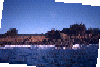
 I did go back in March of 1996 and took the following pictures. They
still do
I did go back in March of 1996 and took the following pictures. They
still do
Links to related images: Nearby. Proofs. Map.
Approximate location: 38.7366981506348N / 123.498001098633W.


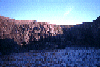 Coves and rocks in the cliff between Stengel and Shell Beaches:
Links to related images: Nearby. Proofs. Map.
Approximate location: 38.7366981506348N / 123.498001098633W.
 Coves and rocks in the cliff between Stengel and Shell Beaches:
Links to related images: Nearby. Proofs. Map.
Approximate location: 38.7366981506348N / 123.498001098633W.
All text and images Copyright © 1996 by Mike Higgins / contact