Shipwrecked on Horseshoe Cove, February 11th 1996
Click on the small image to see the full-sized one.
 Point north of Fisk Mill Cove
Links to related images: Nearby. Proofs. Map.
Approximate location: 38.5956001281738N / 123.357002258301W.
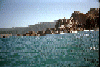
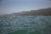 Fisk Mill Cove distant
Links to related images: Nearby. Map.
Approximate location: 38.5827293395996N / 123.344108581543W.
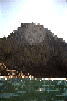 Sentinal Rock from below. Notice the deck, accessable by a trail.
Links to related images: Nearby. Proofs. Map.
Approximate location: 38.595100402832N / 123.348999023438W.
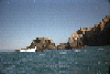
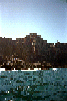
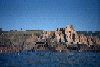
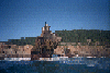
 Fisk Mill cove viewed from the water
Links to related images: Nearby. Proofs. Map.
Approximate location: 38.5956993103027N / 123.350997924805W.
 Red lichen on rock looks like blood at Horseshoe Cove.
Links to related images: Nearby. Proofs. Map.
Approximate location: 38.6090888977051N / 123.371742248535W.
 The tip of the point just south of Horseshoe Cove.
Links to related images: Nearby. Proofs. Map.
Approximate location: 38.6058044433594N / 123.371398925781W.
 Back to the top of the cliff with the recovered paddle.
Links to related images: Nearby. Proofs. Map.
Approximate location: 38.6124458312988N / 123.365737915039W.

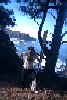
 Me climbing back up with the recovered paddle
Links to related images: Nearby. Proofs. Map.
Approximate location: 38.6124458312988N / 123.365737915039W.

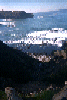 Dad's feet looking down at me climing to Horseshoe Cove
Links to related images: Nearby. Proofs. Map.
Approximate location: 38.6124458312988N / 123.365737915039W.
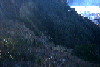 Me climbing down to the beach at Horseshoe Cove
Links to related images: Nearby. Proofs. Map.
Approximate location: 38.6124458312988N / 123.365737915039W.
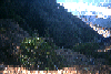
 A view of the ranch over Fishermans Bay to the north
Links to related images: Nearby. Proofs. Map.
Approximate location: 38.6463050842285N / 123.402473449707W.
 But first some images approaching Rock Point from the south:
Links to related images: Nearby. Proofs. Map.
Approximate location: 38.6283378601074N / 123.389427185059W.
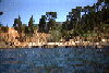
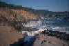
 Pictures of the beach inside the cove created by the point:
Links to related images: Nearby. Proofs. Map.
Approximate location: 38.6304817199707N / 123.387535095215W.
 Rocky point
Links to related images: Nearby. Proofs. Map.
Approximate location: 38.6313552856445N / 123.393714904785W.
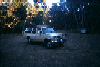 The chariot of Joe Toback who gave me a ride back to my car after my shipwreck.
Links to related images: Nearby. Map.
Approximate location: 38.5815849304199N / 123.334663391113W.
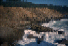
 Shipwrecked (or is it kayak-wrecked) in Hoseshoe Cove.
Links to related images: Nearby. Proofs. Map.
Approximate location: 38.6157302856445N / 123.373893737793W.
 Cormerants on rock in Horseshoe Cove
Links to related images: Nearby. Proofs. Map.
Approximate location: 38.6138534545898N / 123.369941711426W.
All text and images Copyright © 1996 by Mike Higgins / contact