Russian Gulch to Goat Rock and Back, March 2nd, 1996
Click on the small image to see the full-sized one.
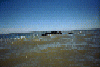
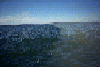
 Waves breaking over rocks offshore from Jenner
Links to related images: Nearby. Proofs. Map.
Approximate location: 38.4545974731445N / 123.145149230957W.
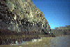
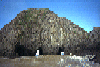
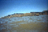 Russian Gulch beach is lost in the clifs here north of Jenner
Links to related images: Nearby. Proofs. Map.
Approximate location: 38.4625930786133N / 123.160690307617W.
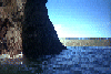
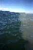
 Waves breaking over rocks offshore from Jenner
Links to related images: Nearby. Proofs. Map.
Approximate location: 38.4488830566406N / 123.140434265137W.
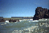
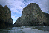
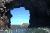 Finally backing off on the far side of Goat Rock Arch
Links to related images: Nearby. Proofs. Map.
Approximate location: 38.4324989318848N / 123.126998901367W.
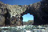
 Then spinning around in the middle of the arch:
Links to related images: Nearby. Proofs. Map.
Approximate location: 38.4324989318848N / 123.126998901367W.
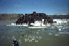
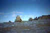
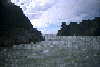
 The 'mud-ocline', fresh Russian River flood water not mixing with salt.
Links to related images: Nearby. Map.
Approximate location: 38.4361763000488N / 123.134338378906W.
 , I paddled through
that rock garden from Russian Gulch Beach and took the follo
, I paddled through
that rock garden from Russian Gulch Beach and took the follo
Links to related images: Nearby. Proofs. Map.
Approximate location: 38.4513702392578N / 123.136566162109W.
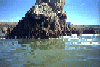
 One big rock off shore from Jenner has a warren of little caves
near the water
One big rock off shore from Jenner has a warren of little caves
near the water
Links to related images: Nearby. Proofs. Map.
Approximate location: 38.4527130126953N / 123.141891479492W.
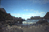 Just south of the beach there is a rocky point separated from the
clifs by a
Just south of the beach there is a rocky point separated from the
clifs by a
Links to related images: Nearby. Proofs. Map.
Approximate location: 38.4582252502441N / 123.145324707031W.
 The last few points, and a gap I paddled through to get to the
Jenner Rock Ga
The last few points, and a gap I paddled through to get to the
Jenner Rock Ga
Links to related images: Nearby. Proofs. Map.
Approximate location: 38.4558067321777N / 123.144203186035W.
All text and images Copyright © 1996 by Mike Higgins / contact