Brooks Island, April 14th 1996.
Click on the small image to see the full-sized one.
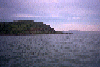
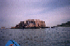
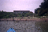
 Brooks Island viewed from the south
Links to related images: Nearby. Proofs. Map.
Approximate location: 37.8895530700684N / 122.360832214355W.
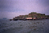
 Brooks Island spt with white birds
Links to related images: Nearby. Proofs. Map.
Approximate location: 37.8995094299316N / 122.366577148438W.
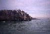
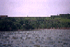
 East shore of Brooks Island
Links to related images: Nearby. Proofs. Map.
Approximate location: 37.8950386047363N / 122.350875854492W.
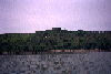
 Rock of south end of Brooks Island
Links to related images: Nearby. Proofs. Map.
Approximate location: 37.8955841064453N / 122.358940124512W.
 South tip of Brooks Island
Links to related images: Nearby. Proofs. Map.
Approximate location: 37.8935852050781N / 122.351669311523W.
 I paddled around Brooks Island in April of 1996.
Links to related images: Nearby. Proofs. Map.
Approximate location: 37.8999519348145N / 122.35587310791W.
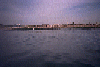
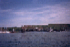
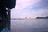 Richmond Harbor
Links to related images: Nearby. Proofs. Map.
Approximate location: 37.906078338623N / 122.363151550293W.
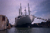 Navy boat in Richmond Harbor
Links to related images: Nearby. Proofs. Map.
Approximate location: 37.9045219421387N / 122.366111755371W.
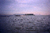
 New pier house for sale on Richmond Waterfront
Links to related images: Nearby. Proofs. Map.
Approximate location: 37.9088554382324N / 122.38069152832W.
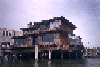
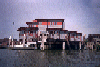 New pier house on Richmond Waterfront
Links to related images: Nearby. Proofs. Map.
Approximate location: 37.9084930419922N / 122.381309509277W.
 Houses and yachts in Richmond Harbor
Links to related images: Nearby. Proofs. Map.
Approximate location: 37.907356262207N / 122.38240814209W.
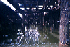
 Under an old burnt out pier in Richmond Harbor
Links to related images: Nearby. Proofs. Map.
Approximate location: 37.9089241027832N / 122.390830993652W.
 Abandoned concrete building on Richmond Point
Links to related images: Nearby. Proofs. Map.
Approximate location: 37.9097366333008N / 122.391044616699W.
All text and images Copyright © 1996 by Mike Higgins / contact