Carquinez Strait, May 23rd 1996.
Click on the small image to see the full-sized one.
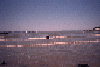
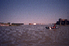
 Dad plowing over the ferry boat wake
Links to related images: Nearby. Proofs. Map.
Approximate location: 38.0766754150391N / 122.240699768066W.
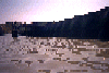
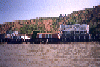 Sandy Beach houses up close
Links to related images: Nearby. Proofs. Map.
Approximate location: 38.076286315918N / 122.240516662598W.
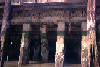
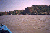 Approaching Sandy Beach again
Links to related images: Nearby. Proofs. Map.
Approximate location: 38.0752563476562N / 122.241096496582W.
 Pelican on old bulkhead
Links to related images: Nearby. Proofs. Map.
Approximate location: 38.0726890563965N / 122.240699768066W.
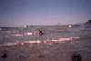
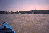 Approaching Sandy Beach from afar
Links to related images: Nearby. Proofs. Map.
Approximate location: 38.0711441040039N / 122.243629455566W.
 Pier Swallow nests on Mare Island pier
Links to related images: Nearby. Proofs. Map.
Approximate location: 38.069751739502N / 122.251266479492W.
 Pier Swallows under Mare Island Pier
Links to related images: Nearby. Proofs. Map.
Approximate location: 38.069751739502N / 122.251266479492W.
 Grafiti on Mare Island pier: "USN Never Again"
Links to related images: Nearby. Proofs. Map.
Approximate location: 38.0691757202148N / 122.251976013184W.
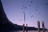
 The breakwater at the end of Mare Island
Links to related images: Nearby. Proofs. Map.
Approximate location: 38.0709495544434N / 122.250823974609W.
 Dad looking across the Carquines Strait
Links to related images: Nearby. Proofs. Map.
Approximate location: 38.069580078125N / 122.250999450684W.
 Dad in my kayak with Mare Island behind him
Links to related images: Nearby. Proofs. Map.
Approximate location: 38.0739059448242N / 122.246932983398W.
 Dad starting out from under a Sandy Beach house
Links to related images: Nearby. Proofs. Map.
Approximate location: 38.0764999389648N / 122.240455627441W.
All text and images Copyright © 1996 by Mike Higgins / contact