Back from Wildcat Camp, June 17 1996.
Click on the small image to see the full-sized one.
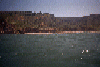
 The creek at the south end of Limantour Beach
Links to related images: Nearby. Proofs. Map.
Approximate location: 38.0136604309082N / 122.851097106934W.
 Through the cave south of Resistance Point
Links to related images: Nearby. Proofs. Map.
Approximate location: 37.9987678527832N / 122.826301574707W.
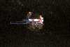
 Landing behind Resistance Point
Links to related images: Nearby. Proofs. Map.
Approximate location: 37.998851776123N / 122.826011657715W.
 Wildcat Beach after a sucessful launch
Links to related images: Nearby. Proofs. Map.
Approximate location: 37.9688491821289N / 122.793907165527W.
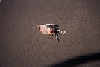 Dead bird on WIldcat Beach
Links to related images: Nearby. Proofs. Map.
Approximate location: 37.9694557189941N / 122.791732788086W.
All text and images Copyright © 1996 by Mike Higgins / contact