Noyo Bay to Mendocino Bay, July 20th 1996.
Click on the small image to see the full-sized one.

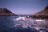


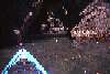
 On June 30th 1996 I took my friend Charles Hessom for a trip around the
Noyo Ha
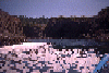
On June 30th 1996 I took my friend Charles Hessom for a trip around the
Noyo Ha
Links to related images: Nearby. Proofs. Map.
Approximate location: 39.3917007446289N / 123.825996398926W.
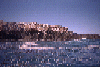
 Point Cabrillo Lighthouse flashing at me
Links to related images: Nearby. Proofs. Map.
Approximate location: 39.34765625N / 123.829116821289W.


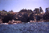
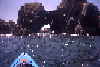
 On June 30th 1996 I took my friend Charles Hessom for a trip around the
Noyo Ha
On June 30th 1996 I took my friend Charles Hessom for a trip around the
Noyo Ha
Links to related images: Nearby. Proofs. Map.
Approximate location: 39.3674430847168N / 123.825485229492W.
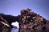 The Big Arch at the Mencocino Headlands
Links to related images: Nearby. Proofs. Map.
Approximate location: 39.3055801391602N / 123.81037902832W.
 Small caves in the Mencocino Headlands
Links to related images: Nearby. Proofs. Map.
Approximate location: 39.3042602539062N / 123.808441162109W.
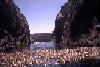
 The long cave through a rock in the Mencocino headlands
Links to related images: Nearby. Proofs. Map.
Approximate location: 39.3087844848633N / 123.811393737793W.
 Arch leading to a beach at the Mencocino Headlands
Links to related images: Nearby. Proofs. Map.
Approximate location: 39.3083839416504N / 123.810661315918W.
 Looking back at an arch in the Mendocino Headlands
Links to related images: Nearby. Proofs. Map.
Approximate location: 39.307430267334N / 123.810585021973W.
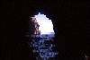
 Rough water in a knotch in the Mendocino Headlands
Links to related images: Nearby. Proofs. Map.
Approximate location: 39.3069725036621N / 123.81095123291W.
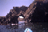
 Looking out a cave at the Mendocino Headlands
Links to related images: Nearby. Proofs. Map.
Approximate location: 39.3087425231934N / 123.810218811035W.
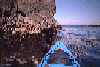
 Kelp and calm water inside the Mendocino Headlands
Links to related images: Nearby. Proofs. Map.
Approximate location: 39.3081703186035N / 123.811561584473W.
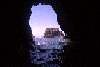
 Looking out a cave at the Mendocino Headlands
Links to related images: Nearby. Proofs. Map.
Approximate location: 39.3080520629883N / 123.810249328613W.
 Short-cut into the Mendocino Headlands
Links to related images: Nearby. Proofs. Map.
Approximate location: 39.3120384216309N / 123.810035705566W.
 Arch in the Mendocino Headlands
Links to related images: Nearby. Proofs. Map.
Approximate location: 39.309886932373N / 123.811981201172W.
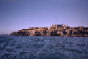
 Approaching the Mendocino Headlands from the north
Links to related images: Nearby. Proofs. Map.
Approximate location: 39.313232421875N / 123.807174682617W.
 Russian Gulch Cove viewed from a distance
Links to related images: Nearby. Proofs. Map.
Approximate location: 39.3232116699219N / 123.816093444824W.

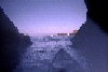
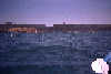
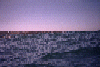 The coastline south of Noyo Bay
Links to related images: Nearby. Proofs. Map.
Approximate location: 39.4202156066895N / 123.819267272949W.
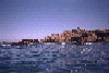
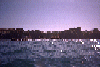
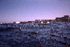 Houses on the end of the north point of Noyo Bay
Links to related images: Nearby. Proofs. Map.
Approximate location: 39.429630279541N / 123.81462097168W.
All text and images Copyright © 1996 by Mike Higgins / contact