Wages Creek to MacKerricher State Park, November 10th 1996.
Click on the small image to see the full-sized one.
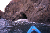
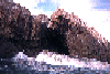
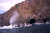
 Arch in large rock, water on the lens
Links to related images: Nearby. Proofs. Map.
Approximate location: 39.5806999206543N / 123.787002563477W.
 Small arches in rocks
Links to related images: Nearby. Proofs. Map.
Approximate location: 39.5806999206543N / 123.787002563477W.
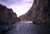
 Looking into a narrow cove with steep rocky walls
Links to related images: Nearby. Proofs. Map.
Approximate location: 39.5806999206543N / 123.787002563477W.
 Hole in cliff above the waterline
Links to related images: Nearby. Proofs. Map.
Approximate location: 39.5806999206543N / 123.787002563477W.
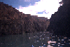
 Landed in a narrow slot in the cliffs
Links to related images: Nearby. Proofs. Map.
Approximate location: 39.5806999206543N / 123.787002563477W.
 Looking up a narrow slot in the cliff
Links to related images: Nearby. Proofs. Map.
Approximate location: 39.5806999206543N / 123.787002563477W.
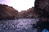
 Rough water over a rocky reef
Links to related images: Nearby. Proofs. Map.
Approximate location: 39.5806999206543N / 123.787002563477W.
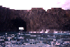
 Looking back at shoreline and sky
Links to related images: Nearby. Proofs. Map.
Approximate location: 39.6390991210938N / 123.789001464844W.
 Large arch offshore
Links to related images: Nearby. Proofs. Map.
Approximate location: 39.6390991210938N / 123.789001464844W.
 Collection of sharp offshore rocks
Links to related images: Nearby. Proofs. Map.
Approximate location: 39.6390991210938N / 123.789001464844W.
 Offshore rocks
Links to related images: Nearby. Proofs. Map.
Approximate location: 39.6390991210938N / 123.789001464844W.
 Pointed rock close to shore
Links to related images: Nearby. Proofs. Map.
Approximate location: 39.6390991210938N / 123.789001464844W.
 Navigable gap between rocks
Links to related images: Nearby. Proofs. Map.
Approximate location: 39.6390991210938N / 123.789001464844W.
 Cave too small to enter
Links to related images: Nearby. Proofs. Map.
Approximate location: 39.6390991210938N / 123.789001464844W.
 Water washing out of hole in rock
Links to related images: Nearby. Proofs. Map.
Approximate location: 39.6390991210938N / 123.789001464844W.
 Shoreline with clouds
Links to related images: Nearby. Proofs. Map.
Approximate location: 39.6390991210938N / 123.789001464844W.
 Evening sky over the water
Links to related images: Nearby. Proofs. Map.
Approximate location: 39.5205001831055N / 123.777000427246W.
 Sand sorted by waves into colored bands
Links to related images: Nearby. Proofs. Map.
Approximate location: 39.5806999206543N / 123.787002563477W.
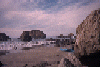 Landed on beach with offshore rocks
Links to related images: Nearby. Proofs. Map.
Approximate location: 39.5806999206543N / 123.787002563477W.
 Wave peaking between rocks, bluffs behind
Links to related images: Nearby. Proofs. Map.
Approximate location: 39.5806999206543N / 123.787002563477W.
 Blow hole and washover rock
Links to related images: Nearby. Proofs. Map.
Approximate location: 39.5806999206543N / 123.787002563477W.
 Blowhole between shows
Links to related images: Nearby. Proofs. Map.
Approximate location: 39.5806999206543N / 123.787002563477W.
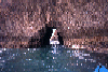
 Looking out a large cave
Links to related images: Nearby. Proofs. Map.
Approximate location: 39.5806999206543N / 123.787002563477W.
 Caves in point too rough to enter
Links to related images: Nearby. Proofs. Map.
Approximate location: 39.5806999206543N / 123.787002563477W.
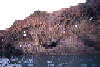
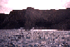
 Sunlight on the top of the cliff
Links to related images: Nearby. Proofs. Map.
Approximate location: 39.5806999206543N / 123.787002563477W.
 Arch too small to paddle through
Links to related images: Nearby. Proofs. Map.
Approximate location: 39.5806999206543N / 123.787002563477W.
All text and images Copyright © 1996 by Mike Higgins / contact