Point Arena Cove to Anchor Bay, July 27th 1997.
Click on the small image to see the full-sized one.
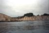
 Landed in beautiful Iverson landing
Links to related images: Nearby. Proofs. Map.
Approximate location: 38.845401763916N / 123.641998291016W.
 Entering Iverson Landing from the outside
Links to related images: Nearby. Proofs. Map.
Approximate location: 38.8446006774902N / 123.647003173828W.
 The exit point of a little cave through a point
Links to related images: Nearby. Proofs. Map.
Approximate location: 38.8462982177734N / 123.648002624512W.
 Houses above the cliffs near Point Arena
Links to related images: Nearby. Proofs. Map.
Approximate location: 38.8468017578125N / 123.647003173828W.
 View out a little cove near Point Arena
Links to related images: Nearby. Proofs. Map.
Approximate location: 38.8468017578125N / 123.647003173828W.
 Small cave that goes all the way through the point
Links to related images: Nearby. Proofs. Map.
Approximate location: 38.8466987609863N / 123.647003173828W.
 View out crack in little cove near Point Arena
Links to related images: Nearby. Proofs. Map.
Approximate location: 38.8470001220703N / 123.647003173828W.
 Houses above the cliffs near Point Arena
Links to related images: Nearby. Proofs. Map.
Approximate location: 38.8470993041992N / 123.648002624512W.
 View across beautiful rock garden near Point Arena
Links to related images: Nearby. Proofs. Map.
Approximate location: 38.8493995666504N / 123.648002624512W.
 View across small cove near Point Arena
Links to related images: Nearby. Proofs. Map.
Approximate location: 38.8488006591797N / 123.647003173828W.
 Paddling into rocky cove near Point Arena
Links to related images: Nearby. Proofs. Map.
Approximate location: 38.8484001159668N / 123.648002624512W.
 Landed on small sandy cove near Point Arena
Links to related images: Nearby. Proofs. Map.
Approximate location: 38.8518981933594N / 123.649002075195W.
 Small sandy cove near Point Arena
Links to related images: Nearby. Proofs. Map.
Approximate location: 38.8512992858887N / 123.651000976562W.
 Crack in the cliffs near Point Arena
Links to related images: Nearby. Proofs. Map.
Approximate location: 38.8526000976562N / 123.651000976562W.
 View out small cove near Iverson Landing
Links to related images: Nearby. Proofs. Map.
Approximate location: 38.8538017272949N / 123.651000976562W.
 Small arch in wall of small cove
Links to related images: Nearby. Proofs. Map.
Approximate location: 38.8540000915527N / 123.651000976562W.
 Landed on tiny cove near Iverson Landing
Links to related images: Nearby. Proofs. Map.
Approximate location: 38.8539009094238N / 123.650001525879W.
 Crack in the cliffs near Point Arena
Links to related images: Nearby. Proofs. Map.
Approximate location: 38.8544998168945N / 123.65299987793W.
 Notch in the cliffs near Point Arena
Links to related images: Nearby. Proofs. Map.
Approximate location: 38.8567008972168N / 123.65299987793W.
 Caves in the cliffs near Point Arena
Links to related images: Nearby. Proofs. Map.
Approximate location: 38.8585014343262N / 123.653999328613W.
 Facing South Only Park (Bowling Ball Beach) viewed from offshore
Links to related images: Nearby. Proofs. Map.
Approximate location: 38.8655014038086N / 123.65599822998W.
 Painted cliffs near Point Arena
Links to related images: Nearby. Proofs. Map.
Approximate location: 38.869499206543N / 123.660003662109W.
 Moat Creek Beach
Links to related images: Nearby. Proofs. Map.
Approximate location: 38.8759994506836N / 123.666999816895W.
 Approaching Moat Creek from the north
Links to related images: Nearby. Proofs. Map.
Approximate location: 38.8758010864258N / 123.666999816895W.
 Close to shore near Point Arena
Links to related images: Nearby. Proofs. Map.
Approximate location: 38.8776016235352N / 123.669998168945W.
 Sandstone cliffs near Point Arena
Links to related images: Nearby. Proofs. Map.
Approximate location: 38.8786010742188N / 123.672996520996W.
 The pier in Point Arena Cove
Links to related images: Nearby. Proofs. Map.
Approximate location: 38.9140014648438N / 123.710998535156W.
 Looking up out a sinkhole near Point Arena
Links to related images: Nearby. Proofs. Map.
Approximate location: 38.9255981445312N / 123.727996826172W.
 Caves and coves near Point Arena
Links to related images: Nearby. Proofs. Map.
Approximate location: 38.9267997741699N / 123.728996276855W.
 Red lichen growing around cave entrance
Links to related images: Nearby. Proofs. Map.
Approximate location: 38.9300994873047N / 123.728996276855W.


 Waterfall near Point Arena
Links to related images: Nearby. Proofs. Map.
Approximate location: 38.9310989379883N / 123.726997375488W.
 Stone pillar just offshore
Links to related images: Nearby. Proofs. Map.
Approximate location: 38.9337997436523N / 123.726997375488W.
 Landed inside the post cave
Links to related images: Nearby. Proofs. Map.
Approximate location: 38.9337997436523N / 123.725997924805W.
 The view out the post cave from the beach
Links to related images: Nearby. Proofs. Map.
Approximate location: 38.9337997436523N / 123.725997924805W.
 Cave with a stone post in the middle
Links to related images: Nearby. Proofs. Map.
Approximate location: 38.9337997436523N / 123.726997375488W.
 Stone pillar viewed from inside a cave
Links to related images: Nearby. Proofs. Map.
Approximate location: 38.934398651123N / 123.726997375488W.
 Two stone pillars guarding a cave
Links to related images: Nearby. Proofs. Map.
Approximate location: 38.934398651123N / 123.727996826172W.
 Arch at the exit of the natual stone warf
Links to related images: Nearby. Proofs. Map.
Approximate location: 38.935001373291N / 123.730003356934W.

 Natural stone formation that looks like a stone warf
Links to related images: Nearby. Proofs. Map.
Approximate location: 38.935001373291N / 123.730003356934W.
 Crack in Sea Lion Island that leads to a natural stone warf
Links to related images: Nearby. Proofs. Map.
Approximate location: 38.935001373291N / 123.730003356934W.
 View back out the cave through Sea Lion Island
Links to related images: Nearby. Proofs. Map.
Approximate location: 38.9364013671875N / 123.730003356934W.
 Inside a cave that goes all the way through Sea Lion Island
Links to related images: Nearby. Proofs. Map.
Approximate location: 38.9365005493164N / 123.730003356934W.
 Looking into the big cave on the north end of Sea Lion Island
Links to related images: Nearby. Proofs. Map.
Approximate location: 38.937198638916N / 123.731002807617W.
 A big arch and cave on north end of Sea Lion Island
Links to related images: Nearby. Proofs. Map.
Approximate location: 38.9374008178711N / 123.730003356934W.
 Gap in the rocks near Point Arena
Links to related images: Nearby. Proofs. Map.
Approximate location: 38.9379997253418N / 123.728996276855W.

 Inside a long cave near Point Arena
Links to related images: Nearby. Proofs. Map.
Approximate location: 38.9393997192383N / 123.730003356934W.
 Tall thin arch near Point Arena
Links to related images: Nearby. Proofs. Map.
Approximate location: 38.9396018981934N / 123.731002807617W.
 Tilted cave near Point Arena
Links to related images: Nearby. Proofs. Map.
Approximate location: 38.9413986206055N / 123.732002258301W.
 Red lichen growing around arch near Point Arena
Links to related images: Nearby. Proofs. Map.
Approximate location: 38.9436988830566N / 123.733001708984W.
All text and images Copyright © 1997 by Mike Higgins / contact