Limantour to Alamere Falls, June 21st 1998.
Click on the small image to see the full-sized one.
 A picnic lunch on the beach at Miller Point.
Links to related images: Nearby. Proofs. Map.
Approximate location: 37.985034942627N / 122.80802154541W.
 We go for a walk from Miller Point towards Alamere Falls.
Links to related images: Nearby. Proofs. Map.
Approximate location: 37.984619140625N / 122.80744934082W.

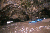
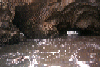
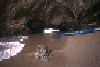
 Great lengths to avoid getting their feet wet aroud a point.
Links to related images: Nearby. Proofs. Map.
Approximate location: 37.9833793640137N / 122.806159973145W.
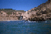
 Beautiful arch near Alamere Falls.
Links to related images: Nearby. Proofs. Map.
Approximate location: 37.9814987182617N / 122.803596496582W.
 We go for a walk from Miller Point towards Alamere Falls.
Links to related images: Nearby. Proofs. Map.
Approximate location: 37.980884552002N / 122.802314758301W.
 Landed near Resistance Point
Links to related images: Nearby. Proofs. Map.
Approximate location: 37.9989013671875N / 122.825996398926W.
 Altamere Falls, and a group of friends hiking up the beach to see the
falls, the
Altamere Falls, and a group of friends hiking up the beach to see the
falls, the
Links to related images: Nearby. Proofs. Map.
Approximate location: 37.9534530639648N / 122.784652709961W.
All text and images Copyright © 1998 by Mike Higgins / contact