Santa Cruz to Moss Landing, August 9th 2001.
Click on the small image to see the full-sized one.
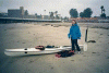
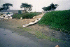
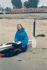 Delicia Liu watching me pack my gear
Links to related images: Nearby. Proofs. Map.
Approximate location: 36.9625015258789N / 122.022003173828W.
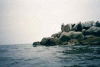
 pod of seals in Santa Cruz Harbor
Links to related images: Nearby. Proofs. Map.
Approximate location: 36.962100982666N / 122.019996643066W.
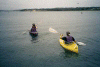
 a double kayak goes by, SC Harbor
Links to related images: Nearby. Proofs. Map.
Approximate location: 36.9608001708984N / 122.014999389648W.
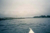
 the view back to SC Beach Boardwalk
Links to related images: Nearby. Proofs. Map.
Approximate location: 36.9598007202148N / 122.012001037598W.
 fuzzy kelp
Links to related images: Nearby. Proofs. Map.
Approximate location: 36.953498840332N / 121.97200012207W.
 jelly fish, kodak didn't print it!
Links to related images: Nearby. Proofs. Map.
Approximate location: 36.9592018127441N / 121.952003479004W.
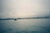
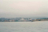
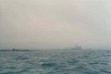 Moss Landing through the fog.
Links to related images: Nearby. Proofs. Map.
Approximate location: 36.8126983642578N / 121.796997070312W.
 into the jetty at last
Links to related images: Nearby. Proofs. Map.
Approximate location: 36.8069000244141N / 121.790000915527W.
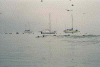
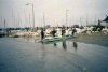
 kayakers at Monterey Bay Kayaks
Links to related images: Nearby. Proofs. Map.
Approximate location: 36.812198638916N / 121.787002563477W.
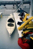
 my kayak at Monterey Bay Kayaks
Links to related images: Nearby. Proofs. Map.
Approximate location: 36.812198638916N / 121.787002563477W.
 kayakers at Monterey Bay Kayaks
Links to related images: Nearby. Proofs. Map.
Approximate location: 36.812198638916N / 121.787002563477W.
 my kayak and gear on Steph Dutton's boat
Links to related images: Nearby. Proofs. Map.
Approximate location: 36.8000984191895N / 121.787002563477W.
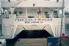 Steph Dutton's boat
Links to related images: Nearby. Proofs. Map.
Approximate location: 36.8000984191895N / 121.787002563477W.
All text and images Copyright © 2001 by Mike Higgins / contact