Cala Mujeres to Isla San Lorenzo, December 27th 2001.
Click on the small image to see the full-sized one.
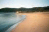
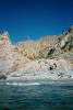
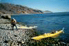
 Launching in the morning to cross to Isla San Lorenzo.
Links to related images: Nearby. Proofs. Map.
Approximate location: 28.461296081543N / 112.884002685547W.
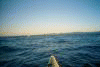
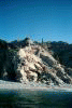
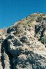
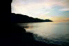
 Getting close to Isla San Lorenzo
Links to related images: Nearby. Proofs. Map.
Approximate location: 28.5845966339111N / 112.785385131836W.
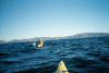
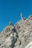
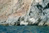
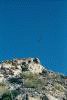 An osprey tries to chase us away
Links to related images: Nearby. Proofs. Map.
Approximate location: 28.5869331359863N / 112.784439086914W.
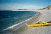
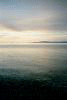
 San Lorenzo shoreline very close now!
Links to related images: Nearby. Proofs. Map.
Approximate location: 28.5869331359863N / 112.784439086914W.
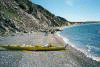
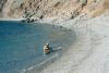
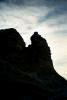
 Our first landing on San Lorenzo Island!
Links to related images: Nearby. Proofs. Map.
Approximate location: 28.5869331359863N / 112.784439086914W.
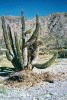
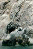
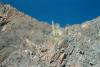
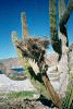 Osprey nests were usually on rocky points, this one in a cardone cactus.
Links to related images: Nearby. Proofs. Map.
Approximate location: 28.5874614715576N / 112.789253234863W.
 Traveling up the west shore of Isla San Lorenzo.
Links to related images: Nearby. Proofs. Map.
Approximate location: 28.611198425293N / 112.800148010254W.
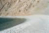
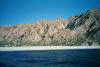
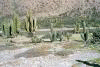
 Isla San Lorenzo shoreline.
Links to related images: Nearby. Map.
Approximate location: 28.6408081054688N / 112.852249145508W.
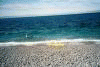
 Our first campsite on Isla San Lorenzo.
Links to related images: Nearby. Map.
Approximate location: 28.6420879364014N / 112.854049682617W.
All text and images Copyright © 2001 by Mike Higgins / contact