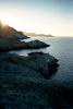
Isla San Lorenzo to Isla Salsipuedes, Baja, December 28th 2001.
Click on the small image to see the full-sized one.
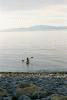

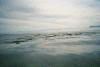
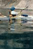
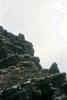
 Launching the next morning and continuing north.
Links to related images: Nearby. Map.
Approximate location: 28.6529350280762N / 112.867866516113W.
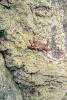
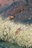
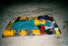
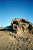
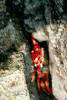 Trying to capture the illusive sally lightfoot on film.
Links to related images: Nearby. Map.
Approximate location: 28.6594123840332N / 112.874824523926W.


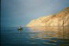
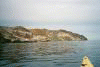 The gap between Islas San Lorenzo and Las Animas.
Links to related images: Nearby. Proofs. Map.
Approximate location: 28.6807231903076N / 112.893966674805W.
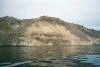
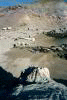
 Paddling up the east side of Isla las Animas.
Links to related images: Nearby. Proofs. Map.
Approximate location: 28.6987934112549N / 112.907264709473W.
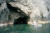
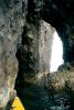


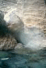
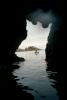 Caves on Isla Las Animas!
Links to related images: Nearby. Proofs. Map.
Approximate location: 28.7079029083252N / 112.928726196289W.


 Traveling across to Isla Salsipuedes and up the west side of that island.
Links to related images: Nearby. Proofs. Map.
Approximate location: 28.7237873077393N / 112.954299926758W.


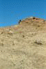 Our campsite on Isla Salsipuedes.
Links to related images: Nearby. Proofs. Map.
Approximate location: 28.7246894836426N / 112.957221984863W.
All text and images Copyright © 2001 by Mike Higgins / contact