Isla Salsipuedes to San Lorenzo, December 29th 2001.
Click on the small image to see the full-sized one.
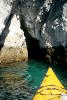
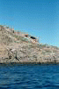
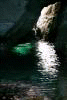
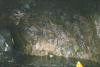
 Look carefully into this cave, there is a black crowned night herron inside!
Links to related images: Nearby. Proofs. Map.
Approximate location: 28.7242374420166N / 112.958168029785W.
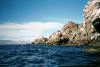

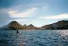
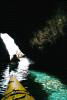
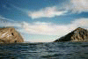
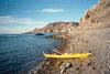
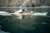
 Paddling around the north end and back down the other side of Isla Salsipuedes.
Links to related images: Nearby. Proofs. Map.
Approximate location: 28.7326679229736N / 112.958679199219W.


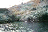
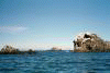
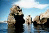
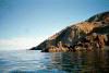
 Down the east side of Isla Salsipuedes.
Links to related images: Nearby. Proofs.
Approximate location: 28.7141513824463N / 112.943489074707W.
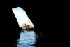
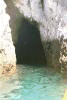
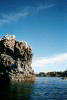
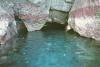
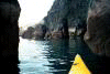
 Back to Isla Las Animas and a beautiful cave to play in!
Links to related images: Nearby. Proofs. Map.
Approximate location: 28.7076778411865N / 112.93155670166W.
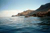
 Continuing down the west side of Isla Las Animas to the gap to Isla San Lorenzo
Links to related images: Nearby. Proofs. Map.
Approximate location: 28.6877269744873N / 112.909240722656W.
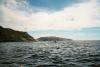
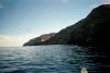
 At first we are going to go down the West side of Isla San Lorenzo.
Links to related images: Nearby. Proofs. Map.
Approximate location: 28.679895401001N / 112.896278381348W.
 Continuing down the west side of Isla Las Animas to the gap to Isla San Lorenzo
Links to related images: Nearby. Proofs. Map.
Approximate location: 28.679895401001N / 112.896278381348W.
 At first we are going to go down the West side of Isla San Lorenzo.
Links to related images: Nearby. Proofs. Map.
Approximate location: 28.6756782531738N / 112.892158508301W.

 Then we change our mind and dash down the east side, trying to find a campgroun
Links to related images: Nearby. Proofs. Map.
Approximate location: 28.6738719940186N / 112.870872497559W.


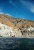
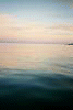
 The east shore of Isla San Lorenzo in the evening.
Links to related images: Nearby. Proofs. Map.
Approximate location: 28.6502990722656N / 112.826667785645W.
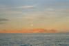
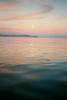
 We fail to find a campsite! The sun goes down, the moon comes up!
Links to related images: Nearby. Proofs. Map.
Approximate location: 28.6019306182861N / 112.762641906738W.
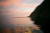
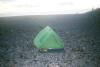 Finally we find a berm on the very south end of Isla San Lorenzo that we can ca
Links to related images: Nearby. Proofs. Map.
Approximate location: 28.5925102233887N / 112.756286621094W.
All text and images Copyright © 2001 by Mike Higgins / contact