Isla San Lorenzo to the Baja Desert, December 30th 2001.
Click on the small image to see the full-sized one.
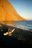
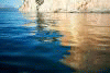
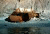
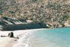
 Launching the next morning to cross back to the main peninsula.
Links to related images: Nearby. Proofs. Map.
Approximate location: 28.5925102233887N / 112.756286621094W.
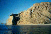
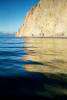
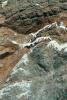
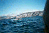
 Paddling around the southern tip of Isla San Lorenzo.
Links to related images: Nearby. Proofs. Map.
Approximate location: 28.5830898284912N / 112.762130737305W.
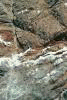
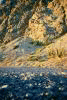
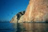
 Blue footed boobies on the cliffs!
Links to related images: Nearby. Proofs. Map.
Approximate location: 28.5764560699463N / 112.773025512695W.
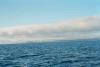
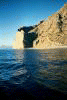
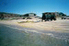 The long crossing back to San Francisquito from Isla San Lorenzo.
Links to related images: Nearby. Proofs. Map.
Approximate location: 28.4255237579346N / 112.865127563477W.
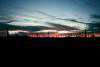
 Camping in the desert on the way home.
Links to related images: Nearby.
Approximate location: 29.2423725128174N / 114.140563964844W.
All text and images Copyright © 2001 by Mike Higgins / contact