Yelapa to Corales, December 29th 2002.
Click on the small image to see the full-sized one.
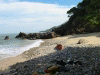
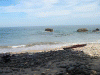
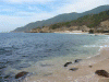
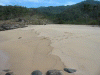
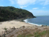
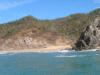
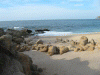
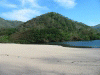
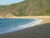
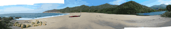 The beach near Corales where I camped for the night.
Links to related images: Nearby. Proofs. Map.
Approximate location: 20.4666996002197N / 105.616996765137W.
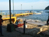 Me, packing for a camping trip at Yelapa Dock
Links to related images: Nearby. Proofs. Map.
Approximate location: 20.4892559051514N / 105.449005126953W.
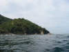
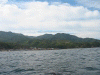
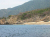
 Houses and people on the point W of Yelapa
Links to related images: Nearby. Proofs. Map.
Approximate location: 20.4946422576904N / 105.455101013184W.
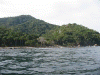
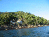
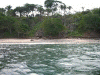
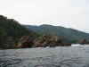 Jungle down to the sea W of Yelapa
Links to related images: Nearby. Proofs. Map.
Approximate location: 20.4960098266602N / 105.461708068848W.
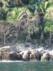
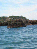
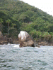 This should be named 'Seal Rock'
Links to related images: Nearby. Proofs. Map.
Approximate location: 20.4965724945068N / 105.463684082031W.
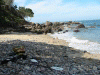
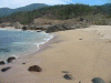
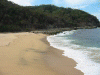
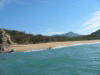
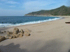
 Beach where we landed the day before for the waterfall
Links to related images: Nearby. Proofs. Map.
Approximate location: 20.4970550537109N / 105.469436645508W.
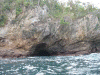
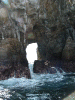
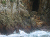
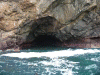 A cave to paddle into!
Links to related images: Nearby. Proofs. Map.
Approximate location: 20.4958477020264N / 105.476821899414W.
 Panorama of gringo enclave
Links to related images: Nearby. Proofs. Map.
Approximate location: 20.4940795898438N / 105.483169555664W.
 Gringo enclave 2nd beach
Links to related images: Nearby. Proofs. Map.
Approximate location: 20.4940795898438N / 105.483169555664W.
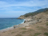
 Town of Chimo, not good beach at low tide
Links to related images: Nearby. Proofs. Map.
Approximate location: 20.4759883880615N / 105.591918945312W.
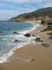
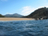
 Lunch stop beach past Chimo
Links to related images: Nearby. Proofs. Map.
Approximate location: 20.4744606018066N / 105.596549987793W.
 Lunch stop beach past Chimo, from offshore
Links to related images: Nearby. Proofs. Map.
Approximate location: 20.4744606018066N / 105.596549987793W.
 Pelicans on rock, fuzzy
Links to related images: Nearby. Proofs. Map.
Approximate location: 20.4754257202148N / 105.60230255127W.
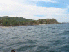
 Next point past Chimo, distant
Links to related images: Nearby. Proofs. Map.
Approximate location: 20.4760684967041N / 105.603507995605W.
 Looking back towards Chimo
Links to related images: Nearby. Proofs. Map.
Approximate location: 20.4760684967041N / 105.603507995605W.
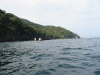
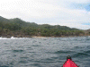
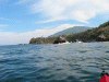
 Approaching Punta La Iglesia
Links to related images: Nearby. Proofs. Map.
Approximate location: 20.4730949401855N / 105.611740112305W.
 Another cave to avoid in a skin kayak
Links to related images: Nearby. Proofs. Map.
Approximate location: 20.4720497131348N / 105.613548278809W.
 smaller rocks before Punta La Iglesia
Links to related images: Nearby. Proofs. Map.
Approximate location: 20.4720497131348N / 105.613548278809W.
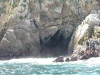
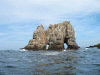
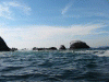
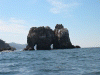 Two arches in Punta La Iglesia!
Links to related images: Nearby. Proofs. Map.
Approximate location: 20.4721298217773N / 105.614921569824W.
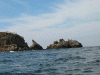
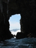
 Left arch in Punta La Iglesia
Links to related images: Nearby. Proofs. Map.
Approximate location: 20.4712448120117N / 105.615608215332W.
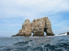
 Right arch in Punta La Iglesia
Links to related images: Nearby. Proofs. Map.
Approximate location: 20.470682144165N / 105.616035461426W.
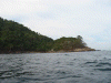
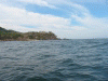
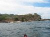
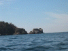
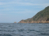
 Punta La Iglesia from the west side
Links to related images: Nearby. Proofs. Map.
Approximate location: 20.4702796936035N / 105.61646270752W.
 Punta La Iglesia from the west side, distant, fuzzy
Links to related images: Nearby. Proofs. Map.
Approximate location: 20.4680290222168N / 105.619468688965W.
 Whale shot, too late, dove.
Links to related images: Nearby. Proofs. Map.
Approximate location: 20.4623985290527N / 105.623329162598W.
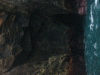
 Cave, too dark
Links to related images: Nearby. Proofs. Map.
Approximate location: 20.4569320678711N / 105.625129699707W.
 Cave too dark
Links to related images: Nearby. Proofs. Map.
Approximate location: 20.4569320678711N / 105.625129699707W.
 Cave above waterline, fuzzy
Links to related images: Nearby. Proofs. Map.
Approximate location: 20.4556446075439N / 105.626846313477W.
 Beach E of Punta Tabito, panorama
Links to related images: Nearby. Proofs. Map.
Approximate location: 20.4426002502441N / 105.640998840332W.
 E end of Punta Tabito E beach
Links to related images: Nearby. Proofs. Map.
Approximate location: 20.4426002502441N / 105.640998840332W.
 Looking W from bluff on Punta Tabito E beach
Links to related images: Nearby. Proofs. Map.
Approximate location: 20.4426002502441N / 105.640998840332W.
 Looking E from bluff on Punta Tabito E beach
Links to related images: Nearby. Proofs. Map.
Approximate location: 20.4426002502441N / 105.640998840332W.
 Punta Tabito
Links to related images: Nearby. Proofs. Map.
Approximate location: 20.4448680877686N / 105.646675109863W.
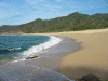
 Large beach W of Punta Tabito, distant
Links to related images: Nearby. Proofs. Map.
Approximate location: 20.4430980682373N / 105.652084350586W.
 arroyo in large Punta Tabito W beach
Links to related images: Nearby. Proofs. Map.
Approximate location: 20.437952041626N / 105.651138305664W.
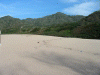
 start of long section of Punta Tabito W beach
Links to related images: Nearby. Proofs. Map.
Approximate location: 20.4364223480225N / 105.651397705078W.
 W end of Punta Tabito W beach
Links to related images: Nearby. Proofs. Map.
Approximate location: 20.4294261932373N / 105.654830932617W.
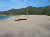
 landed on Punta Tabito W beach.
Links to related images: Nearby. Proofs. Map.
Approximate location: 20.4274959564209N / 105.654655456543W.
 Panorama of Punta Tabito W beach
Links to related images: Nearby. Proofs. Map.
Approximate location: 20.4274959564209N / 105.654655456543W.
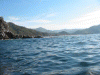
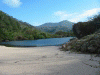
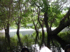
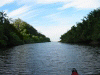
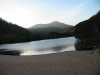
 View down the lagoon behind Punta Tabito W beach
Links to related images: Nearby. Proofs. Map.
Approximate location: 20.4258060455322N / 105.654571533203W.
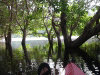
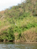
 Under the trees in Punta Tabito Lagoon
Links to related images: Nearby. Proofs. Map.
Approximate location: 20.4266109466553N / 105.653968811035W.
 end of Punta Tabito Lagoon
Links to related images: Nearby. Proofs. Map.
Approximate location: 20.422830581665N / 105.651741027832W.
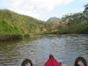
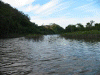 Looking back from end of Punta Tabito Lagoon
Links to related images: Nearby. Proofs. Map.
Approximate location: 20.422830581665N / 105.651741027832W.
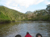
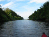
 Looking back from middle of Punta Tabito Lagoon
Links to related images: Nearby. Proofs. Map.
Approximate location: 20.4246006011963N / 105.654228210449W.
 Looking back from end of Punta Tabito Lagoon
Links to related images: Nearby. Proofs. Map.
Approximate location: 20.4246006011963N / 105.654228210449W.
 Fuzzy picture of great blue herron
Links to related images: Nearby. Proofs. Map.
Approximate location: 20.4263687133789N / 105.654571533203W.
 Panga fishermen putting out a net at P T W Beach
Links to related images: Nearby. Proofs. Map.
Approximate location: 20.4272537231445N / 105.654403686523W.
 Evening light on Punta Tabito Lagoon
Links to related images: Nearby. Proofs. Map.
Approximate location: 20.4272537231445N / 105.654403686523W.
All text and images Copyright © 2002 by Mike Higgins / contact