Punta los Machos to La Ballenita, April 16th 2003.
Click on the small image to see the full-sized one.
 Sunrise on Angel de la Guarda camp
Links to related images: Nearby. Proofs. Map.
Approximate location: 29.2812328338623N / 113.483016967773W.
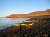
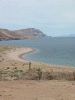
 Calm water at Punta Los Machos
Links to related images: Nearby. Proofs. Map.
Approximate location: 29.2828063964844N / 113.494773864746W.
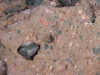
 Guano on rock
Links to related images: Nearby. Proofs. Map.
Approximate location: 29.2903671264648N / 113.498725891113W.
 Patrick with Baja peninsula in background
Links to related images: Nearby. Proofs. Map.
Approximate location: 29.2917881011963N / 113.500953674316W.
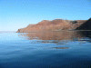
 View north on Angel de la Guarda
Links to related images: Nearby. Proofs. Map.
Approximate location: 29.2992000579834N / 113.503532409668W.
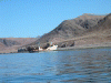 Shrimp boat aground
Links to related images: Nearby. Proofs. Map.
Approximate location: 29.3166370391846N / 113.504905700684W.
 Osprey nest in crows nest
Links to related images: Nearby. Proofs. Map.
Approximate location: 29.3166370391846N / 113.504905700684W.
 Shrimp boat aground
Links to related images: Nearby. Proofs. Map.
Approximate location: 29.3166370391846N / 113.504905700684W.
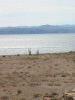
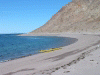 Sandy beach landing
Links to related images: Nearby. Proofs. Map.
Approximate location: 29.3838958740234N / 113.556831359863W.
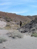 Patrick in small arroyo
Links to related images: Nearby. Proofs. Map.
Approximate location: 29.3838958740234N / 113.556831359863W.
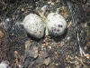 Gull eggs
Links to related images: Nearby. Proofs. Map.
Approximate location: 29.3838958740234N / 113.556831359863W.
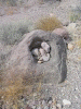 rocks in pothole
Links to related images: Nearby. Proofs. Map.
Approximate location: 29.3764915466309N / 113.552368164062W.
 Patrick on beach from above
Links to related images: Nearby. Proofs. Map.
Approximate location: 29.3784351348877N / 113.555198669434W.
 2nd camp on Angel de la Guarda
Links to related images: Nearby. Proofs. Map.
Approximate location: 29.3784351348877N / 113.555198669434W.
 composite rock
Links to related images: Nearby. Proofs. Map.
Approximate location: 29.3764915466309N / 113.554260253906W.
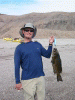 Patrick's 2nd Baja fish
Links to related images: Nearby. Proofs. Map.
Approximate location: 29.3764152526855N / 113.552116394043W.
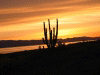 Sunset sky
Links to related images: Nearby. Proofs. Map.
Approximate location: 29.3764152526855N / 113.552116394043W.
All text and images Copyright © 2003 by Mike Higgins / contact