Mike's Kayak Journal, all photos taken on 2003-07-4
Click on the small image to see the full-sized one.
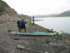
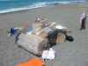
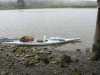 Packing the kayaks at Jenner
Links to related images: Nearby. Proofs. Map.
Approximate location: 38.4496994018555N / 123.115997314453W.
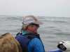
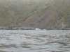
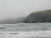 Paddling north past the Jenner Coves
Links to related images: Nearby. Proofs. Map.
Approximate location: 38.4580001831055N / 123.149002075195W.
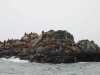
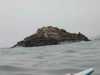 Sea Lions hauled out on a rock
Links to related images: Nearby. Proofs. Map.
Approximate location: 38.4580001831055N / 123.149002075195W.
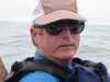
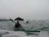
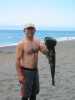
 Jerry Albright paddling north to Lost Beach
Links to related images: Nearby. Proofs. Map.
Approximate location: 38.4580001831055N / 123.149002075195W.
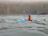
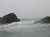
 Paddling north to Lost Beach
Links to related images: Nearby. Proofs. Map.
Approximate location: 38.4580001831055N / 123.149002075195W.
 Sea Lions hauled out on a rock
Links to related images: Nearby. Proofs. Map.
Approximate location: 38.4580001831055N / 123.149002075195W.
 Paddling norh to Lost Beach
Links to related images: Nearby. Proofs. Map.
Approximate location: 38.4580001831055N / 123.149002075195W.
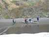 Safely landed at Lost Beach
Links to related images: Nearby. Proofs. Map.
Approximate location: 38.4846992492676N / 123.182998657227W.
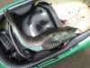
 Joe caught an enormous ling cod for dinner
Links to related images: Nearby. Proofs. Map.
Approximate location: 38.4846992492676N / 123.182998657227W.
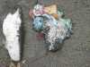 Ling cod guts are incredibly colorfull
Links to related images: Nearby. Proofs. Map.
Approximate location: 38.4846992492676N / 123.182998657227W.
 My favorite camp spot on Lost Beach
Links to related images: Nearby. Proofs. Map.
Approximate location: 38.4846992492676N / 123.182998657227W.
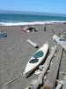 My Coaster on Lost Beach
Links to related images: Nearby. Proofs. Map.
Approximate location: 38.4846992492676N / 123.182998657227W.
 Improvised table on Lost Beach
Links to related images: Nearby. Proofs. Map.
Approximate location: 38.4846992492676N / 123.182998657227W.
All text and images Copyright © 2003 by Mike Higgins / contact