Mike's Kayak Journal, all photos taken on 2004-01-17
Click on the small image to see the full-sized one.
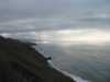 Looking south past Lost Beach to Jenner
Links to related images: Nearby. Proofs. Map.
Approximate location: 38.4897994995117N / 123.190002441406W.
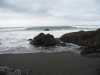
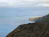 Looking north past Lost Beach to the Fort Ross Reef
Links to related images: Nearby. Proofs. Map.
Approximate location: 38.4897994995117N / 123.190002441406W.
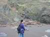
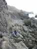
 Kate DesLauriers hiking down the best bad trail to the Sonoma Lost Coast
Links to related images: Nearby. Proofs. Map.
Approximate location: 38.4902000427246N / 123.192001342773W.
 The hot tub site washed out by winter rains
Links to related images: Nearby. Proofs. Map.
Approximate location: 38.4852981567383N / 123.184997558594W.
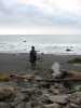
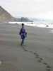 Kate Deslauriers on Lost Beach
Links to related images: Nearby. Proofs. Map.
Approximate location: 38.4846343994141N / 123.183349609375W.
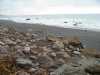
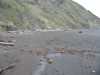
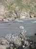
 Flotsam on Lost Beach
Links to related images: Nearby. Proofs. Map.
Approximate location: 38.4846343994141N / 123.183349609375W.

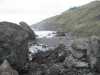
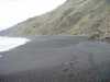 Lost Beach in the dead of winter
Links to related images: Nearby. Proofs. Map.
Approximate location: 38.4846343994141N / 123.183349609375W.
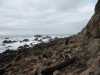 Rough cobble hiking on the Sonoma Lost Coast
Links to related images: Nearby. Proofs. Map.
Approximate location: 38.4822006225586N / 123.180000305176W.
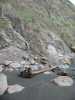
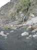
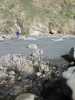
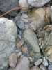 Fresh water flowing through cobble on the Sonoma Lost Coast
Links to related images: Nearby. Proofs. Map.
Approximate location: 38.4814109802246N / 123.178451538086W.
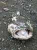 Ling cod head on the Sonoma Lost Coast
Links to related images: Nearby. Proofs. Map.
Approximate location: 38.4805374145508N / 123.178108215332W.

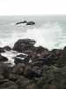
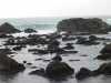 Harbor seals hauled out on the Sonoma Lost Coast
Links to related images: Nearby. Proofs. Map.
Approximate location: 38.4805374145508N / 123.177940368652W.
 Kate DesLauriers on the Sonoma Lost Coast
Links to related images: Nearby. Proofs. Map.
Approximate location: 38.4795951843262N / 123.175537109375W.
 Tide pool on the Sonoma Lost Coast
Links to related images: Nearby. Proofs. Map.
Approximate location: 38.4781837463379N / 123.173988342285W.
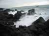
 Wave and rocks on the Sonoma Lost Coast
Links to related images: Nearby. Proofs. Map.
Approximate location: 38.4769744873047N / 123.17253112793W.
 Kate DesLauriers on the Sonoma Lost Coast
Links to related images: Nearby. Proofs. Map.
Approximate location: 38.4771118164062N / 123.171157836914W.
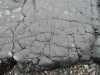 Fractured rock on the Sonoma Lost Coast
Links to related images: Nearby. Proofs. Map.
Approximate location: 38.4761009216309N / 123.169441223145W.
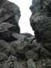 Gap in the rocks on the Sonoma Lost Coast
Links to related images: Nearby. Proofs. Map.
Approximate location: 38.4751625061035N / 123.167892456055W.
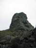 Rock point on the Sonoma Lost Coast
Links to related images: Nearby. Proofs. Map.
Approximate location: 38.4750938415527N / 123.168754577637W.
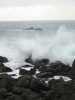 Waves breaking over rocks on the Sonoma Lost Coast
Links to related images: Nearby. Proofs. Map.
Approximate location: 38.4742889404297N / 123.165748596191W.
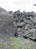
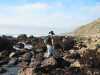
 Kate DesLauriers climbing up rocks on the Sonoma Lost Coast
Links to related images: Nearby. Proofs. Map.
Approximate location: 38.4779167175293N / 123.173561096191W.
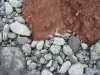 Red and grey rocks on the Sonoma Lost Coast
Links to related images: Nearby. Proofs. Map.
Approximate location: 38.478385925293N / 123.174674987793W.
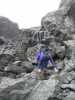
 Kate DesLauriers climing rocks on the Sonoma Lost Coast
Links to related images: Nearby. Proofs. Map.
Approximate location: 38.478385925293N / 123.174674987793W.
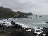 The start of the Jenner Coves on the Sonoma Lost Coast
Links to related images: Nearby. Proofs. Map.
Approximate location: 38.4769744873047N / 123.17261505127W.
 Kate DesLauriers hiking over rocks on the Sonoma Lost Coast
Links to related images: Nearby. Proofs. Map.
Approximate location: 38.4790573120117N / 123.175193786621W.
 Lookng north to Lost Beach on the Sonoma Lost Coast
Links to related images: Nearby. Proofs. Map.
Approximate location: 38.4824180603027N / 123.181457519531W.
 Kate DesLauriers at Lost Beach
Links to related images: Nearby. Proofs. Map.
Approximate location: 38.4849700927734N / 123.184547424316W.
 Tide pools at Lost Beach
Links to related images: Nearby. Proofs. Map.
Approximate location: 38.4855079650879N / 123.185752868652W.
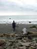
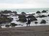
 The intrepid kayaker tide pooling at Lost Beach
Links to related images: Nearby. Proofs. Map.
Approximate location: 38.4855079650879N / 123.185752868652W.
All text and images Copyright © 2004 by Mike Higgins / contact