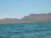
Pit Stop on the Mexican Mainland, April 10th 2004.
Click on the small image to see the full-sized one.
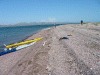
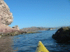 Rock gardening around the camping beach
Links to related images: Nearby. Proofs. Map.
Approximate location: 28.7779655456543N / 112.262420654297W.
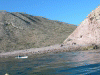 Roger Lamb launching from Isla Tiburon in the morning
Links to related images: Nearby. Proofs. Map.
Approximate location: 28.7779655456543N / 112.262420654297W.
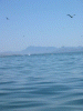
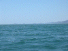
 Pelicans diving in front of Punta San Miguel
Links to related images: Nearby. Proofs. Map.
Approximate location: 28.8794765472412N / 112.235641479492W.
 The town of Punta Chueca distant
Links to related images: Nearby. Proofs. Map.
Approximate location: 28.9769096374512N / 112.185516357422W.
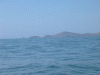
 Looking back at the SE corner of Tiburon Island
Links to related images: Nearby. Proofs. Map.
Approximate location: 28.9769096374512N / 112.185516357422W.
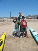
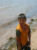 A cute local who turns into an annoying Sand Urchin later
Links to related images: Nearby. Proofs. Map.
Approximate location: 29.0133953094482N / 112.161827087402W.
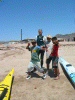
 The Sand Urchins in a good mood
Links to related images: Nearby. Proofs. Map.
Approximate location: 29.0133953094482N / 112.161827087402W.
 Landing on Punta San Miguel
Links to related images: Nearby. Proofs. Map.
Approximate location: 28.9772090911865N / 112.189811706543W.
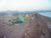
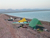 Setting up camp on Punta San Miguel
Links to related images: Nearby. Proofs. Map.
Approximate location: 28.9772090911865N / 112.189811706543W.
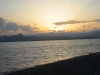 Sunrise over the Mexican mainland
Links to related images: Nearby. Proofs. Map.
Approximate location: 28.9772090911865N / 112.189811706543W.
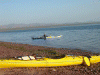 Dave launching first in the morning
Links to related images: Nearby. Proofs. Map.
Approximate location: 28.9772090911865N / 112.189811706543W.
 View back down to the SE corner of Tiburon
Links to related images: Nearby. Proofs. Map.
Approximate location: 28.9757080078125N / 112.188949584961W.
All text and images Copyright © 2004 by Mike Higgins / contact