Crossing back to the main Baja peninsula, April 14th 2004.
Click on the small image to see the full-sized one.
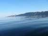
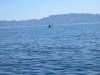
 Last close-up view of Isla San Lorenzo
Links to related images: Nearby. Proofs. Map.
Approximate location: 28.5742702484131N / 112.780838012695W.
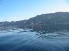
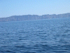
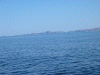
 View ahead to Punta Ballena
Links to related images: Nearby. Proofs. Map.
Approximate location: 28.5742702484131N / 112.780838012695W.
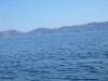
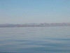
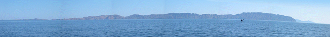
 Panorama- view back to many islands
Links to related images: Nearby. Proofs.
Approximate location: 28.5320510864258N / 112.837829589844W.
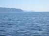
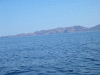
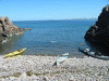
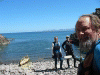
 Our first landing back on the Baja Peninsula on Punta Ballena.
Links to related images: Nearby. Proofs. Map.
Approximate location: 28.4747829437256N / 112.902565002441W.
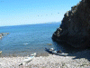
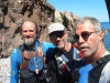
 Our first landing back on the Baja Peninsula on Punta Ballena
Links to related images: Nearby. Proofs. Map.
Approximate location: 28.4747829437256N / 112.902565002441W.
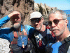
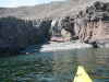
 The ascent team back on the Baja Peninsula at Punta Ballena.
Links to related images: Nearby. Proofs. Map.
Approximate location: 28.4747829437256N / 112.902565002441W.
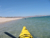
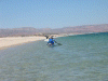 Roger on the way to Dolphin Beach.
Links to related images: Nearby. Proofs. Map.
Approximate location: 28.4659004211426N / 112.934730529785W.
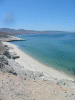
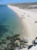 Dolphin Beach viewed from above on the bluff.
Links to related images: Nearby. Proofs. Map.
Approximate location: 28.4567928314209N / 112.971397399902W.
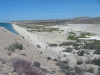
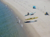 Roger unpacking at Dolphin Beach viewed from above.
Links to related images: Nearby. Proofs. Map.
Approximate location: 28.4567928314209N / 112.971412658691W.
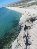
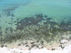 Dolphin Beach Reef viewed down from the bluff.
Links to related images: Nearby. Proofs. Map.
Approximate location: 28.4568004608154N / 112.971000671387W.
 Punta Ballena from the bluf at Dolphin Beach.
Links to related images: Nearby. Proofs. Map.
Approximate location: 28.4568004608154N / 112.971000671387W.
 West view from the bluff at Dolphin Beach.
Links to related images: Nearby. Proofs. Map.
Approximate location: 28.4567928314209N / 112.971412658691W.
 The desert behind the bluff at Dolphin Beach.
Links to related images: Nearby. Proofs. Map.
Approximate location: 28.4567928314209N / 112.971405029297W.
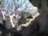
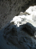 Cave in the desert behind Dolphin Beach.
Links to related images: Nearby. Proofs. Map.
Approximate location: 28.4567928314209N / 112.971412658691W.
 Merged panorama- view back to many islands
Links to related images: Nearby. Proofs.
Approximate location: 28.5211925506592N / 112.849502563477W.
All text and images Copyright © 2004 by Mike Higgins / contact