Bahia Agua Dulce to Punta Perla, October 29th 2004.
Click on the small image to see the full-sized one.
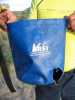
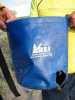
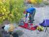
 Senior Coyote chewed on some of our gear at Bahia Agua Dulce
Links to related images: Nearby. Proofs. Map.
Approximate location: 29.1866359710693N / 112.416656494141W.
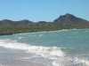
 Approaching the east end of Bahia Agua Dulce on Isla Tiburon
Links to related images: Nearby. Proofs. Map.
Approximate location: 29.2145824432373N / 112.374000549316W.

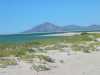
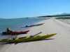
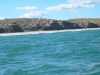 The long white sandy beaches of Bahia Agua Dulce on Isla Tiburon
Links to related images: Nearby. Proofs. Map.
Approximate location: 29.2159309387207N / 112.372367858887W.
 Looking back at the west end of Bahia Agua Dulce on Isla Tiburon
Links to related images: Nearby. Proofs. Map.
Approximate location: 29.2163047790527N / 112.372627258301W.
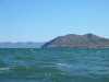
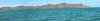
 The Mexican mainland viewed over Punta Perla on Isla Tiburon
Links to related images: Nearby. Proofs. Map.
Approximate location: 29.2223739624023N / 112.340187072754W.

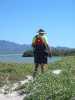
 Hiking over Punta Perla on Isla Tiburon to look for the channel
Links to related images: Nearby. Proofs. Map.
Approximate location: 29.2228984832764N / 112.300270080566W.

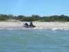
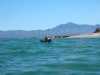
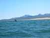
 Fun surf launch at the base of Punta Perla on Isla Tiburon
Links to related images: Nearby. Proofs. Map.
Approximate location: 29.2228984832764N / 112.300270080566W.

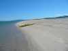
 Spit south of Punta Perla on Isla Tiburon
Links to related images: Nearby. Proofs. Map.
Approximate location: 29.2241706848145N / 112.282165527344W.
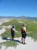
 Re-united with the other kayakers south of Punta Perla
Links to related images: Nearby. Proofs. Map.
Approximate location: 29.2216987609863N / 112.280876159668W.
 Traveling down the low sandy east shore of Isla Tiburon
Links to related images: Nearby. Proofs. Map.
Approximate location: 29.2190017700195N / 112.279670715332W.
 Mangrove trees on the east shore of Isla Tiburon
Links to related images: Nearby. Proofs. Map.
Approximate location: 29.2037944793701N / 112.271522521973W.
 Traveling down the low sandy east shore of Isla Tiburon
Links to related images: Nearby. Proofs. Map.
Approximate location: 29.1982498168945N / 112.26456451416W.
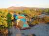
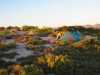
 Camping on the northeast of Isla Tiburon
Links to related images: Nearby. Proofs. Map.
Approximate location: 29.1784687042236N / 112.264137268066W.
All text and images Copyright © 2004 by Mike Higgins / contact