Punta Perla on Isla Tiburon to Punta Granita on the Mexican Mainland, October 30
Click on the small image to see the full-sized one.
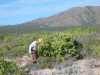
 John Somers breaking camp near Punta Perla on Isla Tiburon
Links to related images: Nearby. Proofs. Map.
Approximate location: 29.178394317627N / 112.264221191406W.
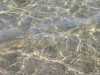 Watered light on sandy bottom near Punta Perla on Isla Tiburon
Links to related images: Nearby. Proofs. Map.
Approximate location: 29.1771202087402N / 112.26448059082W.
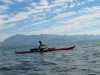
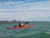
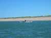
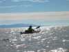 Don Fleming paddling down the Canal el Infernillo on Isla Tiburon
Links to related images: Nearby. Proofs. Map.
Approximate location: 29.155158996582N / 112.256240844727W.
 The only bluffs on the east side of Isla Tiburon
Links to related images: Nearby. Proofs. Map.
Approximate location: 29.0821266174316N / 112.22843170166W.
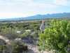
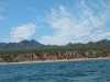
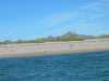
 Most of the east side of Isla Tiburon is sand with scrub
Links to related images: Nearby. Proofs. Map.
Approximate location: 29.056770324707N / 112.215042114258W.
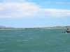
 Approaching the marine base on Punta Tortuga -- Isla Tiburon
Links to related images: Nearby. Proofs. Map.
Approximate location: 29.0254783630371N / 112.197273254395W.
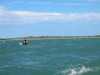
 Don Fleming with Punta Chueca behind him -- Isla Tiburon
Links to related images: Nearby. Proofs. Map.
Approximate location: 29.0148963928223N / 112.189460754395W.
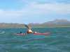
 Lucy O'Brien leads across to Punta Granito -- Sonora
Links to related images: Nearby. Proofs. Map.
Approximate location: 29.0003337860107N / 112.18448638916W.
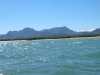
 Wind and tide push us across to Punta Granito -- Sonora
Links to related images: Nearby. Proofs. Map.
Approximate location: 28.9812641143799N / 112.179679870605W.
 A great blue heron on Punta Granito -- Sonora
Links to related images: Nearby. Proofs. Map.
Approximate location: 28.9694004058838N / 112.172470092773W.
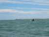
 John Somers crusing along the shore of Punta Granito -- Sonora
Links to related images: Nearby. Proofs. Map.
Approximate location: 28.9647445678711N / 112.168182373047W.
All text and images Copyright © 2004 by Mike Higgins / contact