Mike's Kayak Journal, all photos taken on 2004-12-29
Click on the small image to see the full-sized one.
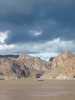
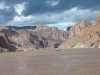 Drifting back after the flash flood.
Links to related images: Nearby. Proofs. Map.
Approximate location: 35.9131011962891N / 114.708000183105W.
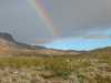
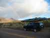 The rainbow on the road on the way out.
Links to related images: Nearby.
Approximate location: 35.8574409484863N / 114.594909667969W.
All text and images Copyright © 2004 by Mike Higgins / contact