Monterey to Monastery Beach, January 22, 2005
Click on the small image to see the full-sized one.
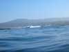
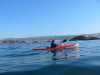
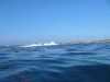
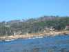
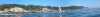
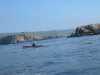
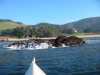
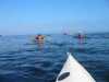 BASKers launching for a whale watching paddle.
Links to related images: Nearby. Proofs. Map.
Approximate location: 36.6369018554688N / 121.930999755859W.
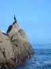
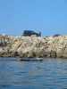 Harbor seal basking on a rock.
Links to related images: Nearby. Proofs. Map.
Approximate location: 36.6378440856934N / 121.932273864746W.
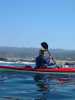
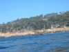
 BASKers launching for a whale watching paddle.
Links to related images: Nearby. Proofs. Map.
Approximate location: 36.6383972167969N / 121.933822631836W.
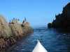
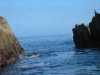
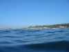
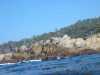
 Gap in the rock near Point Pinos.
Links to related images: Nearby. Proofs. Map.
Approximate location: 36.6388092041016N / 121.937255859375W.
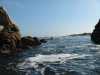
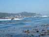
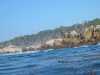
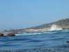
 Waves breaking over the end of Point Pinos.
Links to related images: Nearby. Proofs. Map.
Approximate location: 36.6404991149902N / 121.942001342773W.
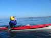
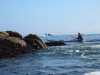
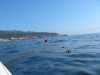
 Joe Petolino looking back at Point Pinos.
Links to related images: Nearby. Proofs. Map.
Approximate location: 36.6343002319336N / 121.942001342773W.
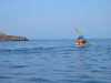
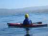
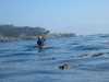
 Joe Petolino at Point Joe!
Links to related images: Nearby. Proofs. Map.
Approximate location: 36.6132011413574N / 121.960998535156W.
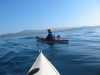
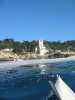
 Joe Petolino approacing Cypress Point.
Links to related images: Nearby. Proofs. Map.
Approximate location: 36.5822486877441N / 121.984382629395W.
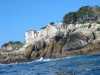
 Cypress Point near Monterey Bay.
Links to related images: Nearby. Proofs. Map.
Approximate location: 36.5822486877441N / 121.984382629395W.
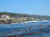
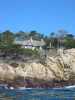
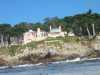
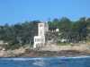
 Houses built on rocks at shoreline near Pescadero Point.
Links to related images: Nearby. Proofs. Map.
Approximate location: 36.5655517578125N / 121.965431213379W.

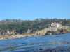
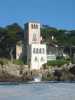
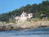
 Houses of the super rich at Pescadero Point.
Links to related images: Nearby. Proofs. Map.
Approximate location: 36.5635986328125N / 121.95955657959W.
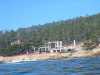
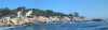
 Panorama of houses at Pescadero Point.
Links to related images: Nearby. Proofs. Map.
Approximate location: 36.5635986328125N / 121.95955657959W.
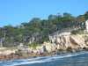
 Castles of houses at Pescadero Point.
Links to related images: Nearby. Proofs. Map.
Approximate location: 36.5635986328125N / 121.95955657959W.
 Panorama of houses at Pescadero Point.
Links to related images: Nearby. Proofs. Map.
Approximate location: 36.5635986328125N / 121.95955657959W.
 More castle houses at Pescadero Point.
Links to related images: Nearby. Proofs. Map.
Approximate location: 36.5634002685547N / 121.959136962891W.
 Joe Petolino entering Stillwater Cove.
Links to related images: Nearby. Proofs. Map.
Approximate location: 36.5632514953613N / 121.94490814209W.
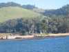 Approaching Monastery Beach
Links to related images: Nearby. Proofs. Map.
Approximate location: 36.5255584716797N / 121.925659179688W.
 Behind a rock at Monastery Beach
Links to related images: Nearby. Proofs. Map.
Approximate location: 36.5255584716797N / 121.925659179688W.
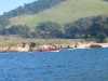
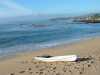 Safely landed at Monastery Beach
Links to related images: Nearby. Proofs. Map.
Approximate location: 36.5255584716797N / 121.925659179688W.
All text and images Copyright © 2005 by Mike Higgins / contact