Spurt Point Cabin to Wood Point, June 26th 2005.
Click on the small image to see the full-sized one.

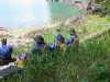
 Blueberries for pancakes at the Spurt Cove cabin
Links to related images: Nearby. Proofs. Map.
Approximate location: 57.0362205505371N / 132.879501342773W.

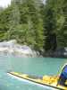
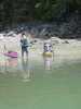 Launching through the mud at Spurt Cove
Links to related images: Nearby. Proofs. Map.
Approximate location: 57.0362205505371N / 132.879501342773W.
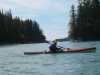
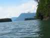
 View across the top of Thomas Bay
Links to related images: Nearby. Proofs. Map.
Approximate location: 57.0694007873535N / 132.849700927734W.
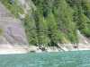
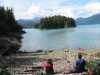
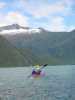
 The end of Scenery Cove
Links to related images: Nearby. Proofs. Map.
Approximate location: 57.0763511657715N / 132.807388305664W.
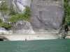 Low tide at Scenery Cove
Links to related images: Nearby. Proofs. Map.
Approximate location: 57.0763511657715N / 132.807388305664W.
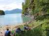
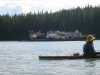
 New friends and their yatch at Scenery Cove
Links to related images: Nearby. Proofs. Map.
Approximate location: 57.0763511657715N / 132.807388305664W.
 The end of the Baird Glacier
Links to related images: Nearby. Proofs. Map.
Approximate location: 57.0777702331543N / 132.825225830078W.
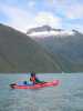
 Leaving Scenery Cove
Links to related images: Nearby. Proofs. Map.
Approximate location: 57.0777702331543N / 132.825225830078W.
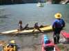
 Lunch stop on Ruth Island
Links to related images: Nearby. Proofs. Map.
Approximate location: 57.0202789306641N / 132.844924926758W.
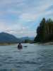
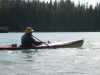
 Joe Petolino starting around Ruth Island
Links to related images: Nearby. Proofs. Map.
Approximate location: 57.0202789306641N / 132.844924926758W.
 Joe Petolino looking across at Cascade Creek
Links to related images: Nearby. Proofs. Map.
Approximate location: 57.0048484802246N / 132.820999145508W.
 Don Fleming looking across at Cascade Creek
Links to related images: Nearby. Proofs. Map.
Approximate location: 57.0048484802246N / 132.820999145508W.
 Don Flemmin near the south end of Ruth Island
Links to related images: Nearby. Proofs. Map.
Approximate location: 56.9852905273438N / 132.813095092773W.
 Joe Petolino passing the 'transfer facility' barge
Links to related images: Nearby. Proofs. Map.
Approximate location: 56.9763107299805N / 132.823760986328W.
 Looking up the west side of Ruth Island
Links to related images: Nearby. Proofs. Map.
Approximate location: 56.9763107299805N / 132.823760986328W.
All text and images Copyright © 2005 by Mike Higgins / contact