Mattole River to Big Flat, September 3rd 2005.
Click on the small image to see the full-sized one.
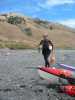
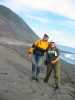
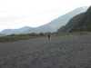 Lucy o'Brien getting ready to launch at Mattole Beach
Links to related images: Nearby. Proofs. Map.
Approximate location: 40.2887001037598N / 124.357002258301W.
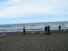 BASKers getting ready to launch at the Mattole River
Links to related images: Nearby. Proofs. Map.
Approximate location: 40.2894897460938N / 124.357627868652W.
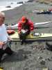
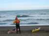 Don Flemming getting ready to launch at the Mattole River
Links to related images: Nearby. Proofs. Map.
Approximate location: 40.2894897460938N / 124.357627868652W.
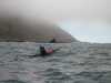
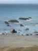
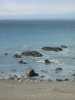
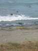
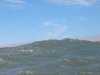
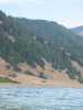
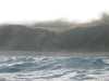 After the launch, looking over waves at the Mattole River Beach
Links to related images: Nearby. Proofs. Map.
Approximate location: 40.2909164428711N / 124.361976623535W.
 Everyone ready to paddle after launching from the Mattole River Beach
Links to related images: Nearby. Proofs. Map.
Approximate location: 40.2927589416504N / 124.365539550781W.
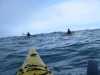
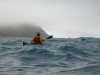
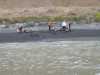
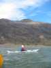
 Dörte Mann paddling south to Punta Gorda
Links to related images: Nearby. Proofs. Map.
Approximate location: 40.2927589416504N / 124.365539550781W.
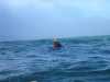
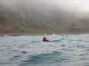
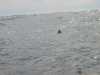
 Dave Littlejohn paddling south to Punta Gorda
Links to related images: Nearby. Proofs. Map.
Approximate location: 40.2927589416504N / 124.365539550781W.
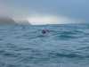
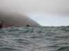
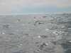
 Don Fleming paddling south to Punta Gorda
Links to related images: Nearby. Proofs. Map.
Approximate location: 40.2927589416504N / 124.365539550781W.
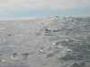
 Fred Cooper paddling south to Punta Gorda
Links to related images: Nearby. Proofs. Map.
Approximate location: 40.2869262695312N / 124.370300292969W.
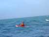
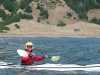
 Lucy O'Brien paddling south to Punta Gorda
Links to related images: Nearby. Proofs. Map.
Approximate location: 40.2927589416504N / 124.365539550781W.
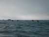 BASKers paddling south to Punta Gorda
Links to related images: Nearby. Proofs. Map.
Approximate location: 40.265251159668N / 124.371757507324W.
 Dave Littlejohn and the first glimpse of the Punta Gorda Lighthouse
Links to related images: Nearby. Proofs. Map.
Approximate location: 40.270938873291N / 124.374908447266W.
 Pictures of my friends from the beach at the Punta Gorda Lighthouse
Links to related images: Nearby. Proofs. Map.
Approximate location: 40.249210357666N / 124.351058959961W.
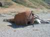
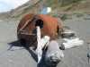
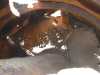
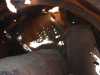
 An old buoy at the Punta Gorda Lighthouse
Links to related images: Nearby. Proofs. Map.
Approximate location: 40.249210357666N / 124.351058959961W.
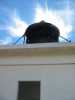
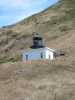 The Punta Gorda Lighthouse from the beach
Links to related images: Nearby. Proofs. Map.
Approximate location: 40.2489738464355N / 124.350532531738W.
 BASKers viewed from up by to the Punta Gorda Lighthouse
Links to related images: Nearby. Proofs. Map.
Approximate location: 40.2493476867676N / 124.350387573242W.
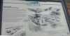 The sign next to the Punta Gorda Lighthouse
Links to related images: Nearby. Proofs. Map.
Approximate location: 40.2493476867676N / 124.350387573242W.
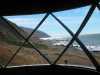
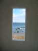 View out the window of the Punta Gorda Lighthouse
Links to related images: Nearby. Proofs. Map.
Approximate location: 40.2493743896484N / 124.350440979004W.
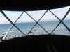 View out the cuppola of the Punta Gorda Lighthouse
Links to related images: Nearby. Proofs. Map.
Approximate location: 40.2493743896484N / 124.350440979004W.
 My kayak viewed from the cuppola of the Punta Gorda Lighthouse
Links to related images: Nearby. Proofs. Map.
Approximate location: 40.2493743896484N / 124.350440979004W.
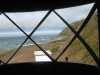 Views north and south from the cuppola of the Punta Gorda Lighthouse
Links to related images: Nearby. Proofs. Map.
Approximate location: 40.2493743896484N / 124.350440979004W.
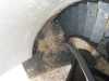
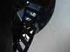 The spiral staircase of the Punta Gorda Lighthouse
Links to related images: Nearby. Proofs. Map.
Approximate location: 40.2493743896484N / 124.350440979004W.
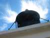
 Sky behind the cuppola of the Punta Gorda Lighthouse
Links to related images: Nearby. Proofs. Map.
Approximate location: 40.2494316101074N / 124.350479125977W.
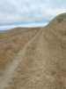
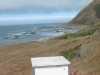
 The Lost Coast Trail north and south from the Punta Gorda Lighthouse
Links to related images: Nearby. Proofs. Map.
Approximate location: 40.2490196228027N / 124.350395202637W.

 Abandoned cabin on the Lost Coast Trail
Links to related images: Nearby. Proofs. Map.
Approximate location: 40.2292900085449N / 124.330009460449W.
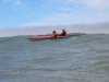
 Don Fleming and Dave Littlejohn south of Punta Gorda
Links to related images: Nearby. Proofs. Map.
Approximate location: 40.2292900085449N / 124.330009460449W.


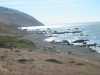
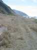
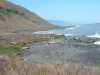
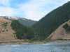
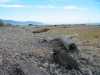
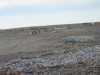
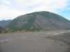
 The north half of the Lost Coast Trail has its own rolling golden hill beauty
Links to related images: Nearby. Proofs. Map.
Approximate location: 40.2080993652344N / 124.294998168945W.
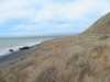 Landed north of Spanish Flat for a lunch stop
Links to related images: Nearby. Proofs. Map.
Approximate location: 40.203540802002N / 124.28955078125W.
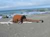
 Mark Short napping at lunch, north of Spanish Flat
Links to related images: Nearby. Proofs. Map.
Approximate location: 40.203540802002N / 124.28955078125W.
 Dörte Mann beachcombing at lunch, north of Spanish Flat
Links to related images: Nearby. Proofs. Map.
Approximate location: 40.203540802002N / 124.28955078125W.

 Fred Cooper and Lucy O'Brien at lunch, north of Spanish Flat
Links to related images: Nearby. Proofs. Map.
Approximate location: 40.203540802002N / 124.28955078125W.
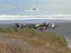
 BASKers launching after lunch, north of Spanish Flat
Links to related images: Nearby. Proofs. Map.
Approximate location: 40.2029838562012N / 124.289878845215W.
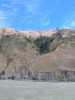
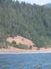
 Inviting valley at the start of Spanish Flat
Links to related images: Nearby. Proofs. Map.
Approximate location: 40.1968612670898N / 124.286003112793W.
 Lucy O'Brien in front of the cabin at Spanish Flat
Links to related images: Nearby. Proofs. Map.
Approximate location: 40.1758193969727N / 124.253349304199W.

 There's a car on a dirt road hidden in the hill here at Spanish Flat
Links to related images: Nearby. Proofs. Map.
Approximate location: 40.1699104309082N / 124.241607666016W.

 Dave Littlejohn and Dörte Mann in front of burned off hill at Spanish Flat
Links to related images: Nearby. Proofs. Map.
Approximate location: 40.1643905639648N / 124.233512878418W.
 Mark Short in front of well maintained cabin at Spanish Flat
Links to related images: Nearby. Proofs. Map.
Approximate location: 40.1606407165527N / 124.224731445312W.
 Dave Littlejohn at the south end of Spanish Flat
Links to related images: Nearby. Proofs. Map.
Approximate location: 40.152530670166N / 124.216293334961W.
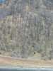
 Patchwork forrest fire damage at the south end of Spanish Flat
Links to related images: Nearby. Proofs. Map.
Approximate location: 40.152530670166N / 124.216293334961W.
 Mother and baby muir near Spanish Flat
Links to related images: Nearby. Proofs. Map.
Approximate location: 40.152530670166N / 124.216293334961W.
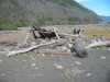
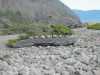
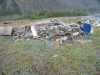
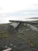
 Driftwood and stone shelters on Miller Flat
Links to related images: Nearby. Proofs. Map.
Approximate location: 40.1272926330566N / 124.174453735352W.
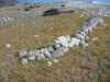
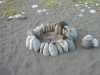
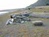
 Rock art at Miller Flat
Links to related images: Nearby. Proofs. Map.
Approximate location: 40.1276397705078N / 124.17406463623W.
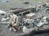
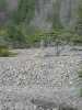
 I don't recall Miller Flat being this rocky last trip
Links to related images: Nearby. Proofs. Map.
Approximate location: 40.1277847290039N / 124.174407958984W.
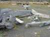
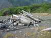
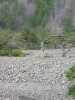
 Driftwood and stone shelters on Miller Flat
Links to related images: Nearby. Proofs. Map.
Approximate location: 40.1294937133789N / 124.179786682129W.
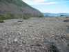
 We land and set up camp on the south end of Big Flat
Links to related images: Nearby. Proofs. Map.
Approximate location: 40.130615234375N / 124.182800292969W.
 A very nice non-ranger, Karen, from BLM comes by
Links to related images: Nearby. Proofs. Map.
Approximate location: 40.130615234375N / 124.182800292969W.
 More patchwork forrest fire damage at Miller Flat
Links to related images: Nearby. Proofs. Map.
Approximate location: 40.1305236816406N / 124.182395935059W.
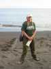
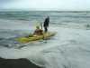 The intrepid kayaker launching from Mattole Beach
Links to related images: Nearby. Proofs. Map.
Approximate location: 40.2890205383301N / 124.357986450195W.
All text and images Copyright © 2005 by Mike Higgins / contact