Santa Barbara to Ventura, September 20th 2005.
Click on the small image to see the full-sized one.
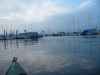
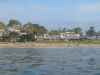
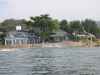
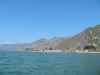
 Paddling out through the Santa Barbara harbort
Links to related images: Nearby. Proofs. Map.
Approximate location: 34.4071388244629N / 119.691581726074W.
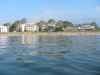
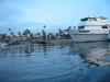
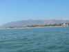
 Montecito and the rest of Santa Barbara County coastline is behind brick-brack
Links to related images: Nearby. Proofs. Map.
Approximate location: 34.4166603088379N / 119.651069641113W.
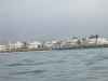
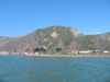
 Carpinterina and the rest of Santa Barbara County coastline is behind brick-brack
Links to related images: Nearby. Proofs. Map.
Approximate location: 34.395191192627N / 119.530670166016W.
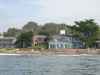
 Carpinteria and the rest of Santa Barbara County coastline is behind brick-brack
Links to related images: Nearby. Proofs. Map.
Approximate location: 34.395191192627N / 119.530670166016W.
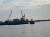
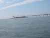 An artificial island built for offshore oil drilling,
Links to related images: Nearby. Proofs. Map.
Approximate location: 34.350700378418N / 119.44100189209W.
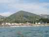
 Southern California camping, a trailer park behind brick-brack
Links to related images: Nearby. Proofs. Map.
Approximate location: 34.3377990722656N / 119.41300201416W.
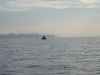
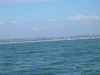 Distant Ventura County coastline
Links to related images: Nearby. Proofs. Map.
Approximate location: 34.302059173584N / 119.360847473145W.
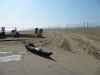 Landed for the evening at Buena Ventura State Beach
Links to related images: Nearby. Proofs.
Approximate location: 34.2672996520996N / 119.27799987793W.
All text and images Copyright © 2005 by Mike Higgins / contact