Ventura to Leo Carrillo State Park, September 21st 2005.
Click on the small image to see the full-sized one.
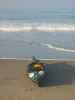
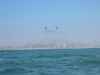
 Ready to launch in Ventura
Links to related images: Nearby. Proofs.
Approximate location: 34.2672004699707N / 119.278999328613W.
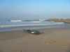
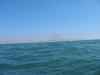
 The Navy's private harbor in Oxnard
Links to related images: Nearby. Proofs. Map.
Approximate location: 34.1430702209473N / 119.214012145996W.
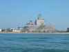
 Electrical Generating Plant
Links to related images: Nearby. Proofs. Map.
Approximate location: 34.0927696228027N / 119.10636138916W.
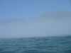
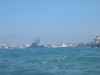
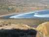
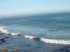
 The cost plays hide and seek behind the fog
Links to related images: Nearby. Proofs. Map.
Approximate location: 34.0558586120605N / 118.980888366699W.
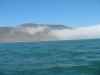
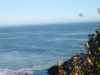
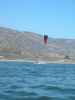 Approaching Leo Carillo I see traction kites
Links to related images: Nearby. Proofs. Map.
Approximate location: 34.0416488647461N / 118.945419311523W.
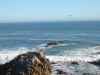
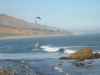
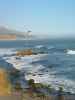 After landing, waves and surfers at Leo Carrillo State Beach
Links to related images: Nearby. Proofs. Map.
Approximate location: 34.0434112548828N / 118.936950683594W.
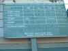 Leo Carrillo State Beach sign, always play it safe!
Links to related images: Nearby. Proofs. Map.
Approximate location: 34.0434112548828N / 118.936950683594W.
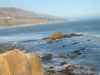
 Wind surfer and traction kiter at Leo Carrillo State Beach
Links to related images: Nearby. Proofs. Map.
Approximate location: 34.0434112548828N / 118.936950683594W.
All text and images Copyright © 2005 by Mike Higgins / contact