Leo Carillo State Beach to Santa Monica, September 22nd 2005.
Click on the small image to see the full-sized one.
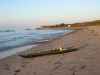
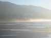
 Ready to launch in the morning at Leo Carrillo State Beach
Links to related images: Nearby. Proofs. Map.
Approximate location: 34.0458488464355N / 118.929527282715W.
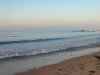
 View back to Leo Carrillo State Beach after launch
Links to related images: Nearby. Proofs. Map.
Approximate location: 34.0458488464355N / 118.929527282715W.

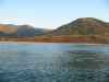
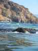
 The back of a big southern swell at Leo Carrillo State Beach
Links to related images: Nearby. Proofs. Map.
Approximate location: 34.0458488464355N / 118.929527282715W.
 Conditions are calm east of Leo Carrillo State Beach
Links to related images: Nearby. Proofs. Map.
Approximate location: 34.0458488464355N / 118.929527282715W.

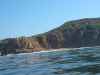
 Beachside Castles east of Leo Carillo State Beach
Links to related images: Nearby. Proofs. Map.
Approximate location: 34.0458488464355N / 118.861938476562W.
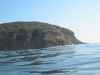
 Point Dume
Links to related images: Nearby. Proofs. Map.
Approximate location: 33.9984397888184N / 118.808120727539W.
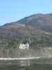
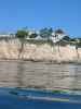 Clifftop Castle near Point Dume
Links to related images: Nearby. Proofs. Map.
Approximate location: 34.0085487365723N / 118.791290283203W.
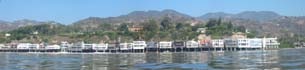 Beachside houses of the only moderately rich in Malibu Beach
Links to related images: Nearby. Proofs. Map.
Approximate location: 34.0281791687012N / 118.714653015137W.
All text and images Copyright © 2005 by Mike Higgins / contact