Redondo Beach to Long Beach, September 24th 2005.
Click on the small image to see the full-sized one.
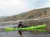
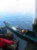
 Fred Cooper helps load the kayak the next morning
Links to related images: Nearby. Proofs. Map.
Approximate location: 33.8339996337891N / 118.385101318359W.
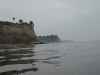
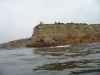
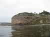
 Palos Verdes Point
Links to related images: Nearby. Proofs. Map.
Approximate location: 33.7756004333496N / 118.429992675781W.
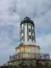
 Point Vicente Lighthouse
Links to related images: Nearby. Proofs. Map.
Approximate location: 33.7413215637207N / 118.414398193359W.
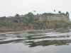
 Long Point, home of Marineland
Links to related images: Nearby. Proofs. Map.
Approximate location: 33.7346305847168N / 118.395278930664W.
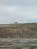
 A local, Blaine, escorts me for a few miles
Links to related images: Nearby. Proofs. Map.
Approximate location: 33.7312202453613N / 118.394996643066W.
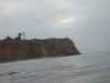
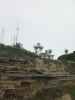
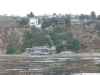 Blaine's house on the cliff
Links to related images: Nearby. Proofs. Map.
Approximate location: 33.7098808288574N / 118.310981750488W.
 A bell from the people of South Korea
Links to related images: Nearby. Proofs. Map.
Approximate location: 33.7060699462891N / 118.298812866211W.
 A lighthouse on Point Ferrnin
Links to related images: Nearby. Proofs. Map.
Approximate location: 33.702751159668N / 118.292098999023W.
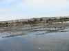 A very regular breakwater outside Los Angeles Harbor
Links to related images: Nearby. Proofs. Map.
Approximate location: 33.7014808654785N / 118.267692565918W.
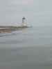
 A lighthouse at an entrance to Los Angeles harbor
Links to related images: Nearby. Proofs. Map.
Approximate location: 33.7072906494141N / 118.250686645508W.
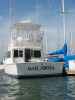 The Bad Boys have a boat in Alamitos Bay
Links to related images: Nearby. Proofs. Map.
Approximate location: 33.7648086547852N / 118.113922119141W.
 I land under a freeway overpass in Long Beach
Links to related images: Nearby. Proofs. Map.
Approximate location: 33.763729095459N / 118.115447998047W.
All text and images Copyright © 2005 by Mike Higgins / contact