Doheny State Beach to Oceanside, September 27th 2005.
Click on the small image to see the full-sized one.
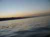
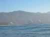
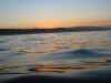 An early morning launch from Doheny State Beach
Links to related images: Nearby. Proofs. Map.
Approximate location: 33.4587211608887N / 117.680000305176W.
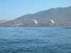
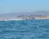
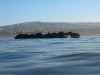 Sea lions on the San Mateo Rocks
Links to related images: Nearby. Proofs. Map.
Approximate location: 33.4040298461914N / 117.618171691895W.
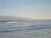

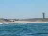
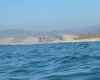
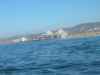 Paddling past the San Onofre Nuclear Generating Station
Links to related images: Nearby. Proofs. Map.
Approximate location: 33.3652610778809N / 117.561698913574W.
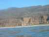
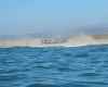
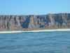 There are places in Southern California where a kayaker could "ninja camp"
Links to related images: Nearby. Proofs. Map.
Approximate location: 33.3220481872559N / 117.496948242188W.
 Marine helecopters on manouvers all day at Camp Pendelton
Links to related images: Nearby. Proofs. Map.
Approximate location: 33.3220481872559N / 117.496948242188W.
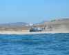
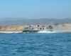

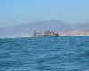
 A Marine hovercraft comes down the ramp and zooms past me!
Links to related images: Nearby. Proofs. Map.
Approximate location: 33.2578315734863N / 117.441291809082W.
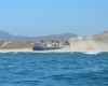
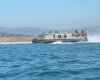
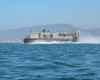
 A different hovercraft lands behind me
Links to related images: Nearby. Proofs. Map.
Approximate location: 33.2578315734863N / 117.441291809082W.
All text and images Copyright © 2005 by Mike Higgins / contact