Mike's Kayak Journal, all photos taken on 2006-04-2
Click on the small image to see the full-sized one.
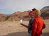
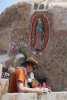 The intrepid kayaker at the Shrine of the Virgin
Links to related images: Nearby. Proofs. Map.
Approximate location: 29.8178005218506N / 114.807998657227W.
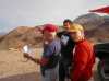
 John Somers, Don Fleming, Doug Hamilton and Dave Harry at the Hotel La Quinta Bonita in Encenada
Links to related images: Nearby. Proofs. Map.
Approximate location: 31.7859687805176N / 116.591636657715W.
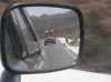
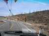 Driving down Highway One in Baja
Links to related images: Nearby.
Approximate location: 30.0728073120117N / 115.625526428223W.
 Dave Harry at the Shrine of the Virgin
Links to related images: Nearby. Proofs. Map.
Approximate location: 29.7621612548828N / 114.757377624512W.
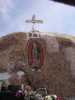 Shrine of the Virgin near Catevena
Links to related images: Nearby. Proofs. Map.
Approximate location: 29.7621612548828N / 114.757377624512W.
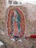
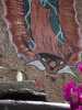 A cheap plastic glow-in-the dark magnetic Virgin getting blessed
Links to related images: Nearby. Proofs. Map.
Approximate location: 29.7621612548828N / 114.757377624512W.
 Safety whistles getting blessed at the Shrine of the Virgin
Links to related images: Nearby. Proofs. Map.
Approximate location: 29.7621612548828N / 114.757377624512W.
 Doug Hamilton at the Shrine of the Virgin
Links to related images: Nearby. Proofs. Map.
Approximate location: 29.7621612548828N / 114.757377624512W.
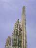 Cardone cactus at the Shrine of the Virgin
Links to related images: Nearby. Proofs. Map.
Approximate location: 29.7621612548828N / 114.757377624512W.
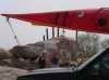
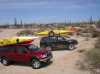 Dave Harry's and my truck at the Shrine of the Virgin
Links to related images: Nearby. Proofs. Map.
Approximate location: 29.7621612548828N / 114.757377624512W.
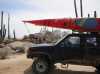
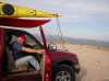
 My truck at the Shrine of the Virgin
Links to related images: Nearby. Proofs. Map.
Approximate location: 29.7621612548828N / 114.757377624512W.
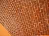 Brick of the hotel roof in Catevena
Links to related images: Nearby. Proofs. Map.
Approximate location: 29.7278060913086N / 114.718635559082W.
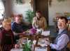
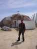
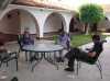 Don Fleming, Dave Harry and Doug Hamilton hanging out in the hotel at Catevena
Links to related images: Nearby. Proofs. Map.
Approximate location: 29.7278060913086N / 114.718635559082W.
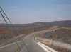
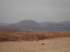
 Checking out the view on the way into Bahia de los Angeles
Links to related images: Nearby.
Approximate location: 28.9722537994385N / 113.606956481934W.
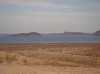
 The view on the way into Bahia de los Angeles
Links to related images: Nearby.
Approximate location: 28.9722537994385N / 113.606956481934W.
 Checking out the view on the way into Bahia de los Angeles
Links to related images: Nearby.
Approximate location: 28.9722537994385N / 113.606956481934W.
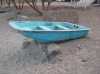
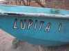
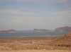
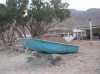 Lupyta's boat sighted in Bahia de los Angeles
Links to related images: Nearby. Proofs. Map.
Approximate location: 28.9477710723877N / 113.557609558105W.
All text and images Copyright © 2006 by Mike Higgins / contact