Bahia de Los Angeles to Cala Mujeres, April 3rd 2006.
Click on the small image to see the full-sized one.
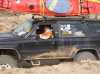
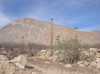
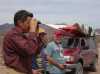
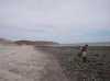
 The intrepid kayaker on the Bad Roads of Baja
Links to related images: Nearby.
Approximate location: 28.8323440551758N / 113.526191711426W.
 Shark Sculpture at Bahia de los Angeles
Links to related images: Nearby. Proofs. Map.
Approximate location: 28.9476222991943N / 113.559066772461W.
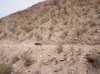
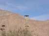 Turkey vultures on cacti on the road to San Francisquito
Links to related images: Nearby.
Approximate location: 28.8803043365479N / 113.533058166504W.
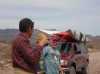
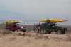
 Doug Hamilton, John Somers and Don Fleming on the road to San Francisquito
Links to related images: Nearby.
Approximate location: 28.8803043365479N / 113.533058166504W.
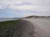
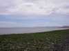
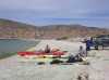
 The beach at Bahia de San Rafael
Links to related images: Nearby. Proofs. Map.
Approximate location: 28.5904006958008N / 113.128105163574W.
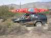
 Dave Harry's truck on the road to San Francisquito
Links to related images: Nearby.
Approximate location: 28.3867950439453N / 113.122657775879W.
 Doug Hamilton and Dave Harry packing kayaks at San Francisquito Cove
Links to related images: Nearby. Proofs. Map.
Approximate location: 28.4254665374756N / 112.864837646484W.
 Doug Hamilton, Dave Harry and Don Fleming packing kayaks at San Francisquito Cove
Links to related images: Nearby. Proofs. Map.
Approximate location: 28.4254665374756N / 112.864837646484W.
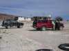
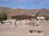
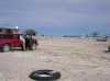 Our trucks at San Francisquito Cove
Links to related images: Nearby. Proofs. Map.
Approximate location: 28.4254665374756N / 112.864837646484W.
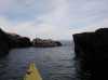 Rock garden in San Francisquito Bay
Links to related images: Nearby. Proofs. Map.
Approximate location: 28.4487133026123N / 112.874069213867W.
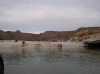 Landing at Cala Mujeres
Links to related images: Nearby. Proofs. Map.
Approximate location: 28.4571552276611N / 112.887954711914W.
All text and images Copyright © 2006 by Mike Higgins / contact