Cala Mujeres to Isla Salsipuedes, April 4th 2006.
Click on the small image to see the full-sized one.
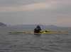
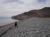
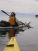
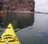
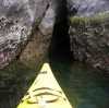
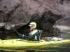 The intrepid kayaker looking for caves on Isla Los Animas
Links to related images: Nearby. Proofs. Map.
Approximate location: 28.6940517425537N / 112.925033569336W.
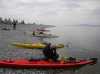
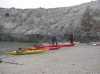
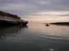 Launching at Cala Mujeres in the morning
Links to related images: Nearby. Proofs. Map.
Approximate location: 28.4571552276611N / 112.887954711914W.
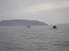
 Dave Harry on the crossing to Isla San Lorenzo
Links to related images: Nearby. Map.
Approximate location: 28.5471324920654N / 112.819633483887W.
 Rest stop on Isla San Lorenzo after the crossing
Links to related images: Nearby. Proofs. Map.
Approximate location: 28.5902500152588N / 112.789421081543W.
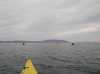
 Paddling up the west shore of Isla San Lorenzo
Links to related images: Nearby. Proofs. Map.
Approximate location: 28.6001968383789N / 112.793365478516W.


 Doug Hamilton at a rest stop on Isla San Lorenzo
Links to related images: Nearby. Proofs. Map.
Approximate location: 28.6136093139648N / 112.805389404297W.


 John Somers paddling up the west shore of Isla San Lorenzo
Links to related images: Nearby. Proofs. Map.
Approximate location: 28.622802734375N / 112.821006774902W.

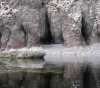
 Beautiful cliffs and caves on the west shore of Isla San Lorenzo
Links to related images: Nearby. Proofs. Map.
Approximate location: 28.6274738311768N / 112.829933166504W.
 We named this Bootie Rock
Links to related images: Nearby. Proofs. Map.
Approximate location: 28.6303367614746N / 112.832679748535W.
 John Somers paddling up the west shore of Isla San Lorenzo
Links to related images: Nearby. Proofs. Map.
Approximate location: 28.6347045898438N / 112.838516235352W.
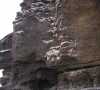 Cliffs with bird nests on the west shore of Isla San Lorenzo
Links to related images: Nearby. Proofs. Map.
Approximate location: 28.6390743255615N / 112.842460632324W.
 Clear water on the west shore of Isla San Lorenzo
Links to related images: Nearby. Proofs. Map.
Approximate location: 28.6390743255615N / 112.842460632324W.
 Bare geology on the west shore of Isla San Lorenzo
Links to related images: Nearby. Proofs. Map.
Approximate location: 28.6404304504395N / 112.846588134766W.
 Dry caves on the west shore of Isla San Lorenzo
Links to related images: Nearby. Map.
Approximate location: 28.6411838531494N / 112.850708007812W.
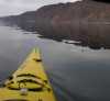
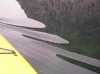 Kayak ripples in the water off Isla San Lorenzo
Links to related images: Nearby. Proofs. Map.
Approximate location: 28.6399040222168N / 112.845893859863W.
 Pelicans on Isla San Lorenzo
Links to related images: Nearby. Map.
Approximate location: 28.6443481445312N / 112.867958068848W.
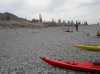
 Pocket cobble beach on Isla San Lorenzo
Links to related images: Nearby. Map.
Approximate location: 28.6490936279297N / 112.865463256836W.

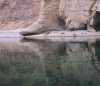
 Caves too small to go inside on Isla San Lorenzo
Links to related images: Nearby. Map.
Approximate location: 28.6594867706299N / 112.876022338867W.
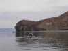
 The gap between Islas Las Animas and San Lorenzo
Links to related images: Nearby. Proofs. Map.
Approximate location: 28.6782398223877N / 112.894393920898W.
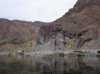
 A beach to stop and rest on Isla Las Animas
Links to related images: Nearby. Proofs. Map.
Approximate location: 28.679895401001N / 112.8955078125W.
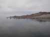
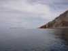 The view past Isla San Lorenzo to Isla San Estiban
Links to related images: Nearby. Proofs. Map.
Approximate location: 28.679744720459N / 112.895164489746W.
 A beach to stop and rest on Isla Las Animas
Links to related images: Nearby. Proofs. Map.
Approximate location: 28.680196762085N / 112.895767211914W.

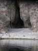
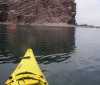
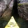
 The first cave to kayak into on Isla Las Animas
Links to related images: Nearby. Proofs. Map.
Approximate location: 28.6841869354248N / 112.900741577148W.
 Sally lightfoot crabs on Isla Las Animas
Links to related images: Nearby. Proofs. Map.
Approximate location: 28.6856937408447N / 112.902976989746W.
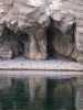
 Another cave on Isla Las Animas
Links to related images: Nearby. Proofs. Map.
Approximate location: 28.6856937408447N / 112.902976989746W.
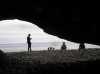 View out a dry cave on Isla Las Animas
Links to related images: Nearby. Proofs. Map.
Approximate location: 28.6943531036377N / 112.92529296875W.
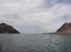
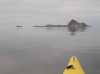
 Isla Salsipuedes past the end of Isla Las Animas
Links to related images: Nearby. Proofs. Map.
Approximate location: 28.6997737884521N / 112.933959960938W.
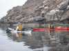 John Somers and Doug Hamilton at the north end of Isla Las Animas
Links to related images: Nearby. Proofs. Map.
Approximate location: 28.7035369873047N / 112.934646606445W.
 Approaching Isla Salsipuedes
Links to related images: Nearby. Proofs.
Approximate location: 28.7096347808838N / 112.939712524414W.
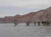
 Doug Hamilton and Don Fleming leaving Isla Las Animas
Links to related images: Nearby. Proofs.
Approximate location: 28.7096347808838N / 112.939712524414W.
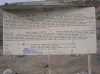
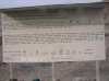 The old good signs on Isla Salsipuedes
Links to related images: Nearby. Proofs. Map.
Approximate location: 28.7246894836426N / 112.956275939941W.
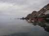
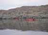
 Doug Hamilton and Dave Harry unpacking on Isla Salsipuedes
Links to related images: Nearby. Proofs. Map.
Approximate location: 28.7246894836426N / 112.957046508789W.
All text and images Copyright © 2006 by Mike Higgins / contact