Isla Partida to Isla Angel de la Guarda, April 7th 2006.
Click on the small image to see the full-sized one.
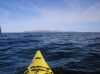
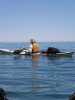
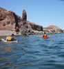
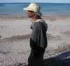
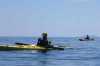 The intrepid kayaker resting on the way to Isla Angel de la Guarda
Links to related images: Nearby. Proofs. Map.
Approximate location: 28.954080581665N / 113.083648681641W.
 My kayak just landed on Isla Angel de la Guarda
Links to related images: Nearby. Proofs. Map.
Approximate location: 29.0061130523682N / 113.116088867188W.
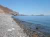
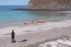 The intrepid kayaker just landed on the white sands of Punta Vibora
Links to related images: Nearby. Proofs. Map.
Approximate location: 29.056770324707N / 113.124847412109W.
 Packing the boats in the morning on Isla Partida
Links to related images: Nearby. Proofs. Map.
Approximate location: 28.8878192901611N / 113.040473937988W.
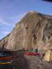
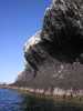
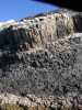
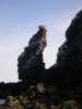
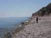
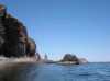
 The basalt cliffs of Isla Partida
Links to related images: Nearby. Proofs. Map.
Approximate location: 28.8857154846191N / 113.038932800293W.
 Packing the boats in the morning on Isla Partida
Links to related images: Nearby. Proofs. Map.
Approximate location: 28.8857154846191N / 113.038932800293W.
 The basalt cliffs of Isla Partida
Links to related images: Nearby. Proofs. Map.
Approximate location: 28.8838367462158N / 113.041244506836W.
 Rounding the south end of Isla Partida
Links to related images: Nearby. Proofs. Map.
Approximate location: 28.8832340240479N / 113.043479919434W.
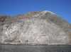
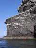 The basalt cliffs of Isla Partida
Links to related images: Nearby. Proofs. Map.
Approximate location: 28.8843612670898N / 113.045883178711W.
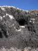
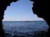 Inside a cave on Isla Partida
Links to related images: Nearby. Proofs. Map.
Approximate location: 28.8839111328125N / 113.045280456543W.
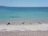
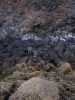 Oyster catchers on Isla Partida
Links to related images: Nearby. Proofs. Map.
Approximate location: 28.8860912322998N / 113.046485900879W.
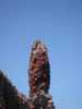
 Osprey nest on spire of basalt
Links to related images: Nearby. Proofs. Map.
Approximate location: 28.8860912322998N / 113.046485900879W.
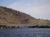
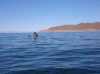
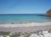
 Looking across to Isla Angel de la Guarda
Links to related images: Nearby. Proofs. Map.
Approximate location: 28.9020957946777N / 113.053779602051W.
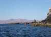
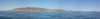 Approaching Islas Angel de la Guarda and El Estanque
Links to related images: Nearby. Proofs. Map.
Approximate location: 28.9700012207031N / 113.099784851074W.
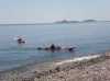 First landing on Isla Angel de la Guarda
Links to related images: Nearby. Proofs. Map.
Approximate location: 29.0121192932129N / 113.114379882812W.
 Paddling north along the shore of Isla Angel de la Guarda
Links to related images: Nearby. Proofs. Map.
Approximate location: 29.0423641204834N / 113.108108520508W.
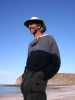
 Dave Harry practicing re-entry rescues off Punta Cerro Prieto
Links to related images: Nearby. Proofs. Map.
Approximate location: 29.0602970123291N / 113.120208740234W.
 Landed at the white sand beach at Punta Cerro Prieto
Links to related images: Nearby. Proofs. Map.
Approximate location: 29.0562438964844N / 113.125190734863W.
 John Weed visits us while at Punta Cerro Prieto
Links to related images: Nearby. Proofs. Map.
Approximate location: 29.0566940307617N / 113.124671936035W.
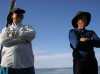 Dave Harry and John Somers listening to John Weed at Punta Cerro Prieto
Links to related images: Nearby. Proofs. Map.
Approximate location: 29.0566940307617N / 113.124671936035W.
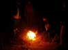 Romantic campfire or trash burning at Punta Cerro Prieto
Links to related images: Nearby. Proofs. Map.
Approximate location: 29.0566940307617N / 113.124671936035W.
All text and images Copyright © 2006 by Mike Higgins / contact