Isla Salsepuedes to Isla San Lorenzo, April 12th 2006.
Click on the small image to see the full-sized one.
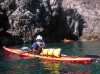
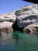
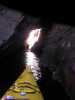
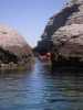
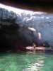
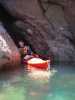
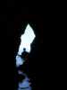
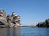
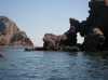
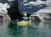 The intrepid kayaker entering a cave on Isla Los Animas
Links to related images: Nearby. Proofs. Map.
Approximate location: 28.7088069915771N / 112.932327270508W.
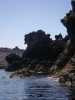
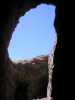
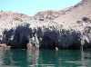
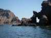
 Arch over cave entrance on Isla Los Animas
Links to related images: Nearby. Proofs. Map.
Approximate location: 28.7072257995605N / 112.928985595703W.
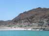
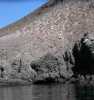
 A panorama of Isla Salsipuedes in morning light
Links to related images: Nearby. Proofs. Map.
Approximate location: 28.7280769348145N / 112.954734802246W.
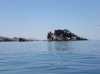
 Our camping cove on the north end of Isla Salsipuedes
Links to related images: Nearby. Proofs. Map.
Approximate location: 28.7280769348145N / 112.954734802246W.
 The double beach on the south end of Isla Salsipuedes
Links to related images: Nearby. Proofs. Map.
Approximate location: 28.7280769348145N / 112.954818725586W.
 Islas Partida and Angel de la Guarda from Isla Salsipuedes
Links to related images: Nearby. Proofs. Map.
Approximate location: 28.7280769348145N / 112.954818725586W.
 Beatles drinking dew off the rocks in the morning on Isla Salsipuedes
Links to related images: Nearby. Proofs. Map.
Approximate location: 28.7281513214111N / 112.955421447754W.
 Coral growths on the rocks at low tide on Isla Salsipuedes
Links to related images: Nearby. Proofs. Map.
Approximate location: 28.7286796569824N / 112.955757141113W.
 Rock shelf exposed at low tide on Isla Salsipuedes
Links to related images: Nearby. Proofs. Map.
Approximate location: 28.7290554046631N / 112.956619262695W.
 Oysters exposed at low tide on Isla Salsipuedes
Links to related images: Nearby. Proofs. Map.
Approximate location: 28.7291297912598N / 112.956962585449W.
 Knob of rock offshore from Isla Salsipuedes
Links to related images: Nearby. Proofs. Map.
Approximate location: 28.7300338745117N / 112.956275939941W.
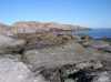
 Rounded rocky shore of Isla Salsipuedes
Links to related images: Nearby. Proofs. Map.
Approximate location: 28.7295074462891N / 112.954986572266W.
 Jagged rocky shore of Isla Salsipuedes
Links to related images: Nearby. Proofs. Map.
Approximate location: 28.7283020019531N / 112.952072143555W.
 Paddling up the east shore of Isla Salsipuedes
Links to related images: Nearby. Proofs. Map.
Approximate location: 28.7252159118652N / 112.949493408203W.

 Doug Hamilton and Don Fleming close to shore on Isla Salsipuedes
Links to related images: Nearby. Proofs. Map.
Approximate location: 28.7242374420166N / 112.949150085449W.

 Pelican on the south tip of Isla Salsipuedes
Links to related images: Nearby. Proofs. Map.
Approximate location: 28.7173137664795N / 112.945976257324W.
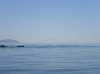

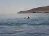
 California sea lions playing in a shallow spot between islands
Links to related images: Nearby. Proofs.
Approximate location: 28.7133235931396N / 112.939628601074W.
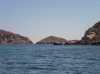
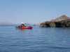 Don Fleming and Doug Hamilton approaching Isla las Animas
Links to related images: Nearby. Proofs.
Approximate location: 28.7133235931396N / 112.939628601074W.

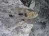
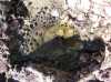
 Sally lightfoot crabs on Isla las Animas
Links to related images: Nearby. Proofs. Map.
Approximate location: 28.7092590332031N / 112.932846069336W.
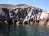
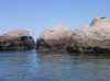
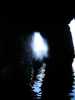
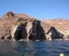
 A cave on Isla las Animas
Links to related images: Nearby. Proofs. Map.
Approximate location: 28.7085819244385N / 112.932067871094W.
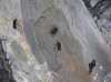
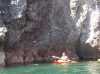
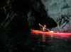
 Don Fleming entering a cave on Isla las Animas
Links to related images: Nearby. Proofs. Map.
Approximate location: 28.7085819244385N / 112.932067871094W.

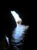
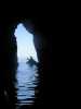
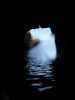
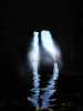
 The view out a cave on Isla las Animas
Links to related images: Nearby. Proofs. Map.
Approximate location: 28.7077522277832N / 112.931732177734W.
 Doug Hamilton through a crack between two caves on Isla las Animas
Links to related images: Nearby. Proofs. Map.
Approximate location: 28.7073764801025N / 112.931732177734W.
 Landed on Isla las Animas to change batteries in my camera
Links to related images: Nearby. Proofs. Map.
Approximate location: 28.7057209014893N / 112.931381225586W.
 Everyone else landed on Isla las Animas for a break
Links to related images: Nearby. Proofs. Map.
Approximate location: 28.705493927002N / 112.932243347168W.

 I found a cave that I took pictures in 5 years ago
Links to related images: Nearby. Proofs. Map.
Approximate location: 28.70361328125N / 112.933013916016W.
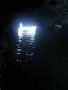

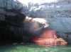
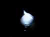
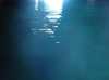 The beautiful blue color of light entering a cave from under water never photographs well
Links to related images: Nearby. Proofs. Map.
Approximate location: 28.70361328125N / 112.933013916016W.
 I found a cave that I took pictures in 5 years ago
Links to related images: Nearby. Proofs. Map.
Approximate location: 28.70361328125N / 112.933013916016W.
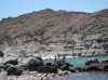
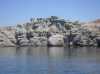 Rock gardens on the west shore of Isla las Animas
Links to related images: Nearby. Proofs. Map.
Approximate location: 28.7045917510986N / 112.933532714844W.
 Rock gardens on the north point of Isla las Animas
Links to related images: Nearby. Proofs. Map.
Approximate location: 28.7097110748291N / 112.933013916016W.
 Doug Hamilton in rock gardens on the north point of Isla las Animas
Links to related images: Nearby. Proofs. Map.
Approximate location: 28.7097110748291N / 112.933013916016W.
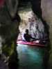
 Cave on the north end of Isla las Animas
Links to related images: Nearby. Proofs. Map.
Approximate location: 28.7092590332031N / 112.931297302246W.
 Doug Hamilton inside one of the 'Emerald Room Caves'
Links to related images: Nearby. Proofs. Map.
Approximate location: 28.7092590332031N / 112.931297302246W.

 Don Fleming paddling into a cave on the north end of Isla las Animas
Links to related images: Nearby. Proofs. Map.
Approximate location: 28.7073764801025N / 112.929664611816W.

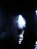
 Beautiful pictures in caves on Isla las Animas ruined by water on the lens!
Links to related images: Nearby. Proofs. Map.
Approximate location: 28.7072257995605N / 112.928466796875W.

 Beautiful pictures in caves on Isla las Animas ruined by water on the lens.
Links to related images: Nearby. Proofs. Map.
Approximate location: 28.7071514129639N / 112.928382873535W.
 Beautiful pictures in caves on Isla las Animas ruined by water on the lens!
Links to related images: Nearby. Proofs. Map.
Approximate location: 28.7071514129639N / 112.928382873535W.
 Doug Hamilton and Don Fleming exiting a narrow crack on Isla Las Animas
Links to related images: Nearby. Proofs. Map.
Approximate location: 28.7052688598633N / 112.926147460938W.
 John Somers stuck in a shallow cave on Isla las Animas
Links to related images: Nearby. Proofs. Map.
Approximate location: 28.7043647766113N / 112.92529296875W.
 Don Fleming and John Somers entering a cave on Isla las Animas
Links to related images: Nearby. Proofs. Map.
Approximate location: 28.6990203857422N / 112.918594360352W.
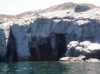 Large 'Emerald Room' cave entrance on Isla las Animas
Links to related images: Nearby. Proofs. Map.
Approximate location: 28.6990947723389N / 112.915252685547W.
 Doug Hamilton and Don Fleming entering a cave on Isla las Animas
Links to related images: Nearby. Proofs. Map.
Approximate location: 28.6990947723389N / 112.915252685547W.
 Sinkhole in the roof of a cave on Isla las Animas
Links to related images: Nearby. Proofs. Map.
Approximate location: 28.6993961334229N / 112.913444519043W.
 Sinkhole cave viewed from another direction
Links to related images: Nearby. Proofs. Map.
Approximate location: 28.6992454528809N / 112.913017272949W.
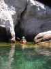
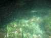 Cave water on Isla las Animas is swarming with baby fish
Links to related images: Nearby. Proofs. Map.
Approximate location: 28.6992454528809N / 112.913017272949W.

 Rock gardening down the east shore of Isla las Animas
Links to related images: Nearby. Proofs. Map.
Approximate location: 28.6984176635742N / 112.905723571777W.
 Baby brown pelicans in nests on the shore of Isla las Animas
Links to related images: Nearby. Proofs. Map.
Approximate location: 28.6972885131836N / 112.904945373535W.
 Rock gardening down the east shore of Isla las Animas
Links to related images: Nearby. Proofs. Map.
Approximate location: 28.6976642608643N / 112.904350280762W.
 Caves on the east shore of Isla las Animas
Links to related images: Nearby. Proofs. Map.
Approximate location: 28.695858001709N / 112.901000976562W.
 Rock gardening down the east shore of Isla las Animas
Links to related images: Nearby. Proofs. Map.
Approximate location: 28.6971378326416N / 112.898597717285W.
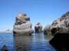
 The gap between Islas las Animas and Lorenzo
Links to related images: Nearby. Proofs. Map.
Approximate location: 28.687650680542N / 112.897483825684W.
 Doug Hamilton approaching the gap between Islas las Animas and Lorenzo
Links to related images: Nearby. Proofs. Map.
Approximate location: 28.6812515258789N / 112.894302368164W.
 The tide rip running between Islas las Animas and Lorenzo
Links to related images: Nearby. Proofs. Map.
Approximate location: 28.6790676116943N / 112.894821166992W.
 Bird nests on the west shore of Isla san Lorenzo
Links to related images: Nearby. Proofs. Map.
Approximate location: 28.6753025054932N / 112.891899108887W.
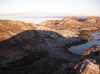
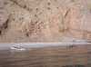 Checking out the camping possibilities on the west shore of Isla san Lorenzo
Links to related images: Nearby. Map.
Approximate location: 28.6658134460449N / 112.878425598145W.
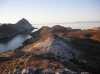
 Cliffs on the west shore of Isla san Lorenzo
Links to related images: Nearby. Map.
Approximate location: 28.6618976593018N / 112.877143859863W.
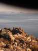
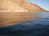 Cliffs reflected in the water on the west shore of Isla san Lorenzo
Links to related images: Nearby. Map.
Approximate location: 28.6532363891602N / 112.870018005371W.
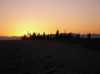
 Sunset through the cardone cactus forest on Isla san Lorenzo
Links to related images: Nearby. Proofs. Map.
Approximate location: 28.5871601104736N / 112.78556060791W.
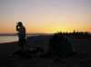 John Somers silhouetted against the sunset on Isla san Lorenzo
Links to related images: Nearby. Proofs. Map.
Approximate location: 28.5871601104736N / 112.78556060791W.
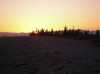
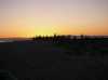 Sunset through the cardone cactus forest on Isla san Lorenzo
Links to related images: Nearby. Proofs. Map.
Approximate location: 28.5871601104736N / 112.78556060791W.
 The granite gravel beach we camped on Isla san Lorenzo
Links to related images: Nearby. Proofs. Map.
Approximate location: 28.5871601104736N / 112.78556060791W.
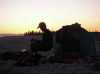 John Somers silhouetted against the sunset on Isla san Lorenzo
Links to related images: Nearby. Proofs. Map.
Approximate location: 28.5871601104736N / 112.785217285156W.
All text and images Copyright © 2006 by Mike Higgins / contact