Elk to Van Damme State Park, June 24th and 25th 2006.
Click on the small image to see the full-sized one.
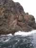
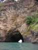
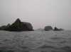
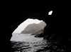
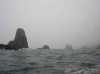
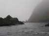
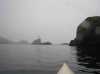
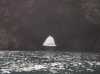
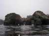 Fillagree arches in Gunderson Cove
Links to related images: Nearby. Proofs. Map.
Approximate location: 39.1301345825195N / 123.721618652344W.
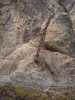
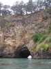
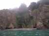
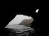
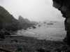
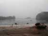
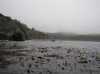 Looking back at Gunderson Cove
Links to related images: Nearby. Proofs. Map.
Approximate location: 39.1299934387207N / 123.72184753418W.
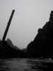
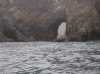
 The sentinel pole on Wharf Rock
Links to related images: Nearby. Proofs. Map.
Approximate location: 39.1311912536621N / 123.722770690918W.
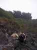
 Concrete step on Wharf Rock
Links to related images: Nearby. Proofs. Map.
Approximate location: 39.131217956543N / 123.722877502441W.
 Big chain on Wharf Rock
Links to related images: Nearby. Proofs. Map.
Approximate location: 39.1313095092773N / 123.722778320312W.
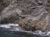
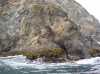
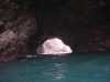
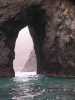
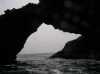
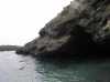
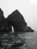
 The big arch in Wharf Rock
Links to related images: Nearby. Proofs. Map.
Approximate location: 39.1311569213867N / 123.722846984863W.
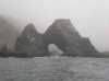
 The sentinel pole through the big arch in Wharf Rock
Links to related images: Nearby. Proofs. Map.
Approximate location: 39.1309013366699N / 123.723213195801W.
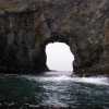
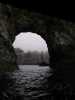
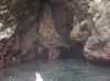
 Looking out to sea through the big arch in Wharf Rock
Links to related images: Nearby. Proofs. Map.
Approximate location: 39.1310348510742N / 123.723037719727W.
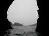
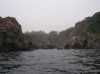
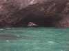
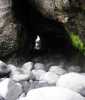
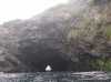
 Cave through to small cove
Links to related images: Nearby. Proofs. Map.
Approximate location: 39.1353607177734N / 123.72240447998W.
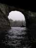
 Looking back through cave from cove
Links to related images: Nearby. Proofs. Map.
Approximate location: 39.1359176635742N / 123.72184753418W.
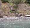 Colapsed stairs into small cove
Links to related images: Nearby. Proofs. Map.
Approximate location: 39.1360092163086N / 123.721748352051W.
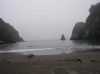
 Rock garden at Cuffey Point
Links to related images: Nearby. Proofs. Map.
Approximate location: 39.1381340026855N / 123.728927612305W.
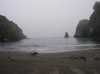
 The camping beach at Cuffey Cove
Links to related images: Nearby. Proofs. Map.
Approximate location: 39.1423950195312N / 123.734977722168W.
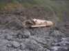
 Abalone shells on Cuffey Cove Beach
Links to related images: Nearby. Proofs. Map.
Approximate location: 39.1423606872559N / 123.734886169434W.
 Out the back of the big cave through Cuffey Point
Links to related images: Nearby. Proofs. Map.
Approximate location: 39.1424026489258N / 123.736373901367W.
 Cave through a rock north of Cuffey Point
Links to related images: Nearby. Proofs. Map.
Approximate location: 39.149974822998N / 123.738227844238W.
 Small rocky cave north of Cuffey Point
Links to related images: Nearby. Proofs. Map.
Approximate location: 39.1523361206055N / 123.738700866699W.
 Foggy rock garden north of Cuffey Point
Links to related images: Nearby. Proofs. Map.
Approximate location: 39.1601219177246N / 123.738914489746W.
 Cave to a driftwood beach north of Cuffey Point
Links to related images: Nearby. Proofs. Map.
Approximate location: 39.169921875N / 123.746459960938W.

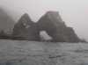
 Huge arch north of Cuffey Point
Links to related images: Nearby. Proofs. Map.
Approximate location: 39.1702537536621N / 123.746627807617W.
 Rock garden south of the Navaro River
Links to related images: Nearby. Proofs. Map.
Approximate location: 39.1723518371582N / 123.74934387207W.

 Arch of the Navaro
Links to related images: Nearby. Proofs. Map.
Approximate location: 39.1915435791016N / 123.765556335449W.
 Ninja campsite on Salmon Point
Links to related images: Nearby. Proofs. Map.
Approximate location: 39.2144813537598N / 123.774604797363W.
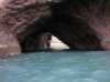
 Small cave through Salmon Point
Links to related images: Nearby. Proofs. Map.
Approximate location: 39.2146644592285N / 123.774795532227W.
 North side of Salmon Point
Links to related images: Nearby. Proofs. Map.
Approximate location: 39.2181739807129N / 123.771949768066W.
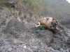
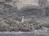 Great Blue Heron in Albion Cove
Links to related images: Nearby. Proofs. Map.
Approximate location: 39.2264671325684N / 123.776351928711W.
 Fog horn in Albion Cove
Links to related images: Nearby. Proofs. Map.
Approximate location: 39.2290115356445N / 123.772766113281W.

 Ninja campsite in Albion Cove
Links to related images: Nearby. Proofs. Map.
Approximate location: 39.2296447753906N / 123.773010253906W.
 Arch north of Albion
Links to related images: Nearby. Proofs. Map.
Approximate location: 39.2339668273926N / 123.779708862305W.
 The long cave under Heritage House
Links to related images: Nearby. Proofs. Map.
Approximate location: 39.2420349121094N / 123.778861999512W.
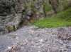
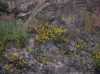 Flowers above the cave entrance under Heritage House
Links to related images: Nearby. Proofs. Map.
Approximate location: 39.2420997619629N / 123.778945922852W.
 Perfect ninja camp location in Buckhorn Cove
Links to related images: Nearby. Proofs. Map.
Approximate location: 39.26220703125N / 123.787101745605W.
All text and images Copyright © 2006 by Mike Higgins / contact