Mike's Kayak Journal, all photos taken on 2006-06-25
Click on the small image to see the full-sized one.
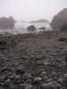 Buckhorn Cove at minus tide in the morning
Links to related images: Nearby. Proofs. Map.
Approximate location: 39.26220703125N / 123.787101745605W.
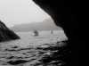
 Leaving Buckhorn Cove in the morning
Links to related images: Nearby. Proofs. Map.
Approximate location: 39.2625617980957N / 123.787864685059W.

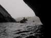
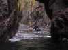
 Inside the Cemetary Cave
Links to related images: Nearby. Proofs. Map.
Approximate location: 39.2675895690918N / 123.788482666016W.
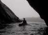 Ralph and Renee Higgins entering Cemetary Cave
Links to related images: Nearby. Proofs. Map.
Approximate location: 39.2675895690918N / 123.788482666016W.

 Ralph Higgins and a kayak tour group inside Mikes Cave of Doom
Links to related images: Nearby. Proofs. Map.
Approximate location: 39.264705657959N / 123.78791809082W.
All text and images Copyright © 2006 by Mike Higgins / contact