Destruction Island to Tunnel Island, August 11th 2006.
Click on the small image to see the full-sized one.
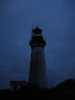 Light visible in the Destruction Island Light in the morning
Links to related images: Nearby. Proofs. Map.
Approximate location: 47.6745986938477N / 124.486999511719W.
 We get water from the newest cistern on Destruction Island
Links to related images: Nearby. Proofs. Map.
Approximate location: 47.6745986938477N / 124.486999511719W.
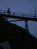
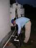
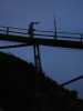 Roger Lamb getting dive-bombed by gulls on the Destruction Island Walkway
Links to related images: Nearby. Proofs. Map.
Approximate location: 47.6731986999512N / 124.486000061035W.
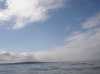
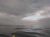 Calm water in the lee of Destruction Island
Links to related images: Nearby. Proofs. Map.
Approximate location: 47.6679000854492N / 124.477996826172W.
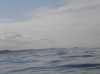
 Approaching the mainland after leaving Destruction Island
Links to related images: Nearby. Proofs. Map.
Approximate location: 47.5980987548828N / 124.387001037598W.

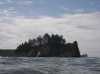
 Approaching Tunnel Island
Links to related images: Nearby. Proofs. Map.
Approximate location: 47.4654998779297N / 124.347999572754W.
 Roger Lamb landing behind Tunnel Island
Links to related images: Nearby. Proofs. Map.
Approximate location: 47.4631004333496N / 124.343002319336W.
 Landed behind Tunnel Island
Links to related images: Nearby. Proofs. Map.
Approximate location: 47.4631004333496N / 124.343002319336W.

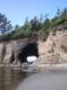 The big tunnel in Tunnel Island
Links to related images: Nearby. Proofs. Map.
Approximate location: 47.4631004333496N / 124.343002319336W.
 Landed behind Tunnel Island
Links to related images: Nearby. Proofs. Map.
Approximate location: 47.4631004333496N / 124.343002319336W.
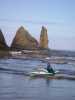
 Pointy sea stack off Tunnel Island
Links to related images: Nearby. Proofs. Map.
Approximate location: 47.4631004333496N / 124.343002319336W.
 Flotsam on the beach behind Tunnel Island
Links to related images: Nearby. Proofs. Map.
Approximate location: 47.4631004333496N / 124.341003417969W.

 Paddling up the Raft River behind Tunnel Island
Links to related images: Nearby. Proofs. Map.
Approximate location: 47.461799621582N / 124.335998535156W.


 Looking back down the Raft River behind Tunnel Island
Links to related images: Nearby. Proofs. Map.
Approximate location: 47.4612007141113N / 124.338996887207W.
All text and images Copyright © 2006 by Mike Higgins / contact