Tunnel Island to Elk Creek, August 12th 2006.
Click on the small image to see the full-sized one.
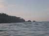
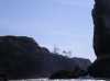
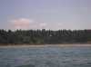
 Sunrise on the arches of Tunnel Island
Links to related images: Nearby. Proofs. Map.
Approximate location: 47.4612007141113N / 124.338996887207W.
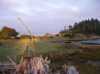
 Our Ninja campsite on the Raft River behind Tunnel Island
Links to related images: Nearby. Proofs. Map.
Approximate location: 47.4612007141113N / 124.338996887207W.
 Sunrise on the arches of Tunnel Island
Links to related images: Nearby. Proofs. Map.
Approximate location: 47.4612007141113N / 124.338996887207W.
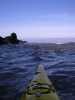
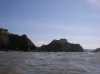
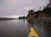 Drifting down the Raft River towards Tunnel Rock
Links to related images: Nearby. Proofs. Map.
Approximate location: 47.4625015258789N / 124.342002868652W.


 The Raft River flows through the arches of Elephant Rock
Links to related images: Nearby. Proofs. Map.
Approximate location: 47.4612998962402N / 124.343002319336W.
 Roger Lamb launching in the protection of Elephant Rock
Links to related images: Nearby. Proofs. Map.
Approximate location: 47.4603042602539N / 124.343948364258W.
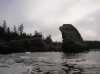

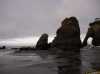
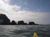
 Elephant and Tunnel Rock viewed from the outside
Links to related images: Nearby. Proofs. Map.
Approximate location: 47.4609985351562N / 124.345664978027W.
 Unusual plant or is it an animal?
Links to related images: Nearby. Map.
Approximate location: 47.4109535217285N / 124.354080200195W.
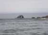
 Willoughby and Split rocks south of Tunnel Island
Links to related images: Nearby. Map.
Approximate location: 47.410026550293N / 124.354080200195W.
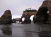
 Can we fit through this arch in Cape Elizabeth?
Links to related images: Nearby. Proofs. Map.
Approximate location: 47.3558044433594N / 124.31957244873W.
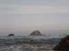
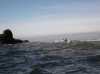 Rounding Cape Elizabeth in choppy water
Links to related images: Nearby. Proofs. Map.
Approximate location: 47.355339050293N / 124.320434570312W.
 Approaching Point Grenville
Links to related images: Nearby. Proofs. Map.
Approximate location: 47.3121185302734N / 124.287040710449W.


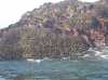
 We paddled through a rock garden off Point Grenville
Links to related images: Nearby. Proofs. Map.
Approximate location: 47.3029251098633N / 124.27897644043W.
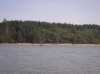
 Sandy beach in the middle of Point Grenville
Links to related images: Nearby. Proofs. Map.
Approximate location: 47.3027496337891N / 124.27734375W.

 We paddled through a rock garden off Point Grenville
Links to related images: Nearby. Proofs. Map.
Approximate location: 47.3009452819824N / 124.273651123047W.
 We missed the Grenville Arch by going so close to shore
Links to related images: Nearby. Proofs. Map.
Approximate location: 47.3004188537598N / 124.271934509277W.

 Once inside Point Grenville there were cars and kids on the beach
Links to related images: Nearby. Proofs. Map.
Approximate location: 47.300594329834N / 124.270820617676W.
 House with observatory dome on Grenville Bay
Links to related images: Nearby. Proofs. Map.
Approximate location: 47.2827224731445N / 124.246704101562W.
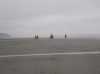
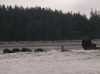
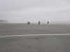 We got advice from locals on horseback after landing south of Pacific Beach
Links to related images: Nearby. Proofs. Map.
Approximate location: 47.1965942382812N / 124.203018188477W.
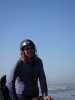
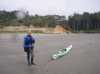 Roger Lamb after landing south of Pacific Beach
Links to related images: Nearby. Proofs. Map.
Approximate location: 47.1965942382812N / 124.203018188477W.
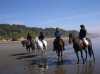 We got advice from locals on horseback after landing south of Pacific Beach
Links to related images: Nearby. Proofs. Map.
Approximate location: 47.1965942382812N / 124.203018188477W.
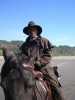 I asked John here if his last name was Wayne
Links to related images: Nearby. Proofs. Map.
Approximate location: 47.1965942382812N / 124.203018188477W.
 Sage gave us protien bars after watching us land through the surf
Links to related images: Nearby. Proofs. Map.
Approximate location: 47.1965942382812N / 124.203018188477W.
All text and images Copyright © 2006 by Mike Higgins / contact