Gray's Harbor to Ledbetter Point, August 14th 2006.
Click on the small image to see the full-sized one.
 Launching from Grays Harbor in the morning
Links to related images: Nearby. Proofs. Map.
Approximate location: 46.9052467346191N / 124.122680664062W.

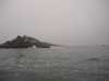 Rounding the south jetty when leaving Grays Harbor
Links to related images: Nearby. Proofs. Map.
Approximate location: 46.9050712585449N / 124.159759521484W.
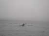 Roger lamb paddling south from Grays Harbor
Links to related images: Nearby. Proofs. Map.
Approximate location: 46.863655090332N / 124.143966674805W.
 The crew of this fishing boat was impressed to find us skirting the Willapa Shoal
Links to related images: Nearby. Proofs. Map.
Approximate location: 46.7009658813477N / 124.13597869873W.
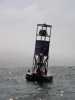
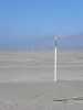
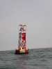 The Channel marker for Willapa Bay
Links to related images: Nearby. Proofs. Map.
Approximate location: 46.677001953125N / 124.140441894531W.
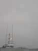
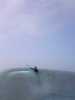 Water on the lens ruins many pictures, this one is artistic
Links to related images: Nearby. Proofs. Map.
Approximate location: 46.6662254333496N / 124.116241455078W.
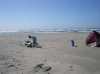
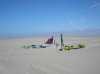 Ninja camping on Leadbetter Point
Links to related images: Nearby. Proofs. Map.
Approximate location: 46.6454277038574N / 124.070404052734W.
 Breakers over the shoal off Leadbetter Point
Links to related images: Nearby. Proofs. Map.
Approximate location: 46.6454277038574N / 124.070404052734W.
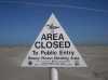
 We camped between the high tide and the snowy plover reserve
Links to related images: Nearby. Proofs. Map.
Approximate location: 46.645076751709N / 124.070404052734W.
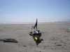
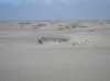 Small sand dunes on Leadbetter Point
Links to related images: Nearby. Proofs. Map.
Approximate location: 46.6443672180176N / 124.070922851562W.
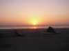 Sunset over our Ninja camp on Leadbetter Point
Links to related images: Nearby. Proofs. Map.
Approximate location: 46.6447830200195N / 124.070236206055W.
All text and images Copyright © 2006 by Mike Higgins / contact