Punta Cacareo to Mulege, March 30th 2007.
Click on the small image to see the full-sized one.
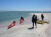
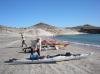 Doug Hamilton and Herb Howe loading kayaks at Punta Cacareo
Links to related images: Nearby. Proofs. Map.
Approximate location: 27.06437N / 111.95661W.
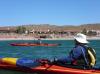
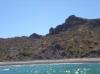
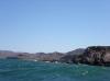
 Rounding Punta Chivato
Links to related images: Nearby. Proofs. Map.
Approximate location: 27.06437N / 111.95661W.
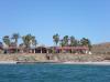
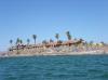
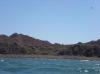
 Expensive gringo houses on the beach at Punta Chivato
Links to related images: Nearby. Proofs. Map.
Approximate location: 27.06437N / 111.95661W.
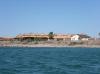
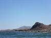
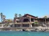 Hotel/Restaurant/Bar near Punta Chivato
Links to related images: Nearby. Proofs. Map.
Approximate location: 27.06439N / 111.95727W.
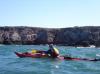
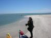 Kate DesLauriers at Boca el Mojon
Links to related images: Nearby. Proofs. Map.
Approximate location: 27.02405N / 112.01079W.
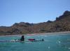
 Everyong landing for a break inside Boca el Mojon
Links to related images: Nearby. Proofs. Map.
Approximate location: 27.02407N / 112.01079W.
 The end of the sandy beach in Bahia Santa Ines
Links to related images: Nearby. Proofs. Map.
Approximate location: 26.95225N / 111.99811W.
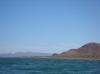
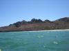
 Rounding Punta Raza and Punta Prieta, approaching Mulege
Links to related images: Nearby. Proofs. Map.
Approximate location: 26.91419N / 111.95553W.
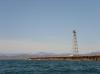
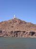 The Mulege Faro
Links to related images: Nearby. Proofs. Map.
Approximate location: 26.9118N / 111.95491W.
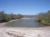
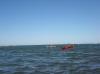 Everyone entering the Estero Mulege
Links to related images: Nearby. Proofs. Map.
Approximate location: 26.9118N / 111.95491W.
 A restaurant in Mulege had this sticker on a window
Links to related images: Nearby. Proofs. Map.
Approximate location: 26.89792N / 111.9742W.
All text and images Copyright © 2007 by Mike Higgins / contact