Mike's Kayak Journal, all photos taken on 2007-07-4
Click on the small image to see the full-sized one.
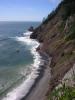
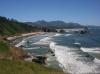
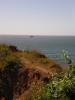
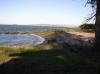
 Looking down on Tillamook Head
Links to related images: Nearby. Proofs. Map.
Approximate location: 45.9336619704673N / 123.9831161499W.
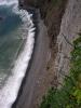
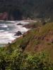
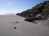
 Looking down on Indian Beach
Links to related images: Nearby. Proofs. Map.
Approximate location: 45.9316323219776N / 123.98062705994W.
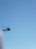
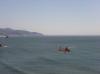 Helicopter rescue from Ecola Point
Links to related images: Nearby. Proofs. Map.
Approximate location: 45.9183183744568N / 123.97702217102W.
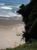
 Looking down to Chapman Point
Links to related images: Nearby. Proofs. Map.
Approximate location: 45.9183780853896N / 123.97650718689W.
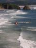
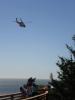
 Helicopter rescue from Ecola Point
Links to related images: Nearby. Proofs. Map.
Approximate location: 45.9184377962582N / 123.97745132446W.
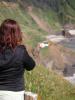 Kate Deslauriers and helicopter rescue from Ecola Point
Links to related images: Nearby. Proofs. Map.
Approximate location: 45.9186169284785N / 123.97788047791W.
 Helicopter rescue from Ecola Point
Links to related images: Nearby. Proofs. Map.
Approximate location: 45.9186766390901N / 123.97805213928W.
 Tillamook Rock from Ecola Point
Links to related images: Nearby. Proofs. Map.
Approximate location: 45.9185572178027N / 123.97882461548W.

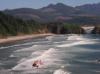
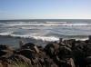 South Jetty of the Columbia River
Links to related images: Nearby. Proofs. Map.
Approximate location: 46.225007533469N / 124.01062488556W.


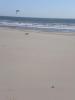
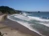
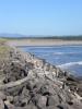
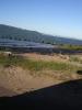
 Fort Stevens State Park Beach
Links to related images: Nearby. Proofs. Map.
Approximate location: 46.2243246582914N / 124.00905847549W.
 Kate at Fort Stevens State Park Beach
Links to related images: Nearby. Proofs. Map.
Approximate location: 46.224369193888N / 124.00925159454W.
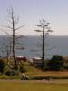
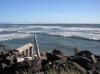
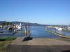 Hammond Marina boat ramp
Links to related images: Nearby. Proofs. Map.
Approximate location: 46.2026018273943N / 123.95286083221W.
 Columbia River Beach in Hammond
Links to related images: Nearby. Proofs. Map.
Approximate location: 46.2058838175932N / 123.95144462585W.
All text and images Copyright © 2007 by Mike Higgins / contact